California’s Record Drought Is Making Earth’s Surface Rise
Lifting land shows that the U.S. West is now missing some 62 trillion gallons of water
/https://tf-cmsv2-smithsonianmag-media.s3.amazonaws.com/filer/3a/3a/3a3a0424-b024-40c7-86b3-bad49807f658/42-58669846.jpg)
The record-breaking California drought is so bad that monitoring stations used to study earthquakes can detect the drying ground rising up. Measurements of these subtle movements, made using GPS instruments, suggest that the western United States is missing some 62 trillion gallons of water, enough to cover the entire region six inches deep.
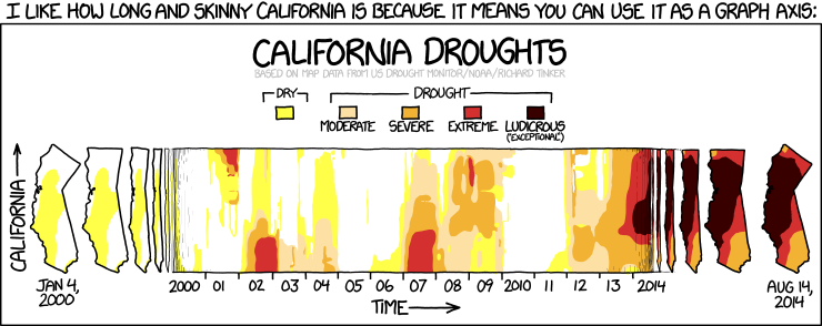
Drought has plagued various parts of the western United States for years. California’s dry times started at the beginning of 2013 and have continued to worsen. Nearly 100 percent of the state is now experiencing drought conditions, according to the U.S. Drought Monitor, and more than half the state falls under the most severe category of “exceptional drought.” Water restrictions are in place. Farmers have been hard hit. And some people are even questioning participation in the viral “ice-bucket challenge” that is raising awareness and funding for amyotrophic lateral sclerosis (ALS).
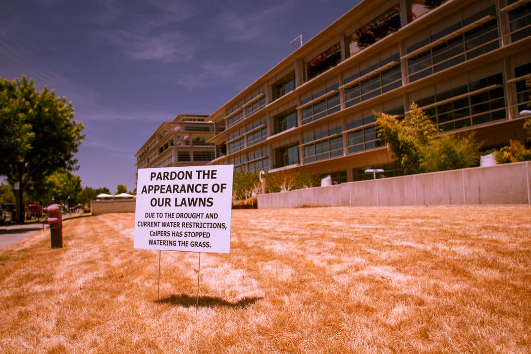
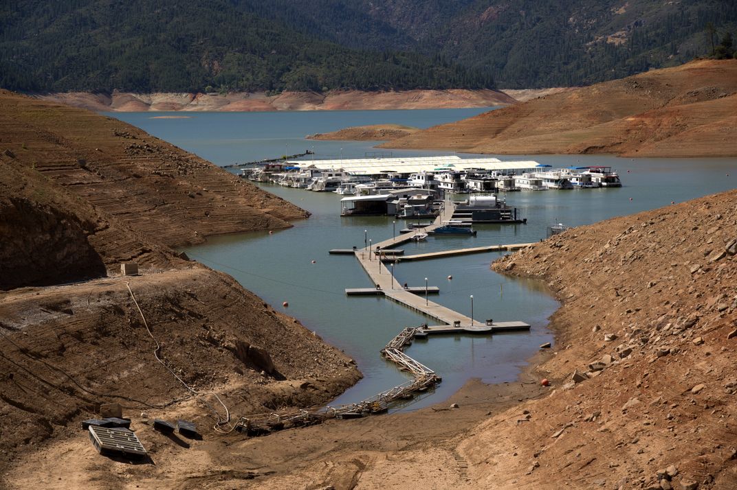
While it’s not difficult to see parched lawns and drying lakes, and scientists can directly measure changes in rainfall and stream flow, getting a measure of how much water has been lost from the desiccating landscape hasn’t been easy. The new study, appearing today in the journal Science, provides a way to do just that by taking advantage of GPS monitors set up across the country.
The Plate Boundary Observatory consists of more than 1,000 permanent GPS stations, with the majority concentrated along the seismically active West Coast. The stations measure millimeter-size movements of the ground, and scientists use that data to study what is happening at the boundary between the Pacific and North American tectonic plates. But Adrian Borsa, a geophysicist at the Scripps Institution of Oceanography in La Jolla, California, noticed an odd trend in the data: Most of the stations have been gradually rising in the last couple of years, just when the region was drying out.
Earth’s surface moves up and down depending on the amount of water in the ground, in much the same way that a block of rubber moves down when you press on it and rebounds when you relieve the pressure. “It is the natural elastic response of most materials,” Borsa says. Earth will rise slightly as groundwater drains away and pressure decreases. But with rock, the effect is generally too small to see unless you look over great distances with highly sensitive gear.
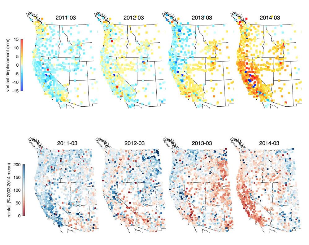
So Borsa and his colleagues mapped Earth’s surface movements from 772 stations between 2003 and March 2014. They made sure to ignore data from monitors near sites that were changing due to geologic reasons, as well as those near aquifers and along California’s Central Valley, where underground water is being pumped out. On local scales, draining an aquifer causes the ground to subside rather than lift up, because the surface collapses to fill in the space left behind.
The team saw small movements from year to year, but by March 2013, most stations in southern California had begun to steadily rise. By March of this year, nearly all of the monitoring units across California, Oregon, Washington, Nevada, Idaho, Utah and Nevada experienced uplift. Maps of the station movements match neatly with maps of deviation from normal precipitation.
The movements in California have been tiny—on average just 0.15 inches, with up to half an inch in the mountains. But they reflect an enormous amount of water lost from reservoirs, snowpack and groundwater.
“The existing GPS network in the western U.S.—and anywhere, for that matter—can now be used to provide a real-time picture of the total water available to the natural and built environment,” says Borsa.
Earlier this year, one study suggested that pumping water out of the large aquifer sitting beneath the center of California could affect the San Andreas fault. If there’s one bit of good news from the latest study, it comes from Borsa’s colleague Duncan Agnew, who conducted an analysis of the stress on the San Andreas due to the drying of California. Agnew, Borsa says, found only a negligible impact on seismicity.
/https://tf-cmsv2-smithsonianmag-media.s3.amazonaws.com/accounts/headshot/Sarah-Zielinski-240.jpg)


/https://tf-cmsv2-smithsonianmag-media.s3.amazonaws.com/accounts/headshot/Sarah-Zielinski-240.jpg)