Introducing the Global Effort to Map the Night Sky
How astronomers around the world are piecing together a patchwork quilt of celestial activity
/https://tf-cmsv2-smithsonianmag-media.s3.amazonaws.com/filer/ba/1b/ba1be523-05ef-4444-b738-6b00f78d8ccb/plot_nov28-dec14_camsb.jpg)
At 8:16 pm on September 30th, a bright fireball raced through the sky above the United Arab Emirates. In the desert below, cameras winked to life, automatically tracking and recording the fireball’s passage. Monitoring stations of the nascent UAE Astronomical Cameras Network stored the data and shared it with other stations spread around the globe. Meteor astronomer Peter Jenniskens at the SETI Institute in California would use that data to calculate the fireball’s trajectory and reconstruct the orbit that brought it to Earth.
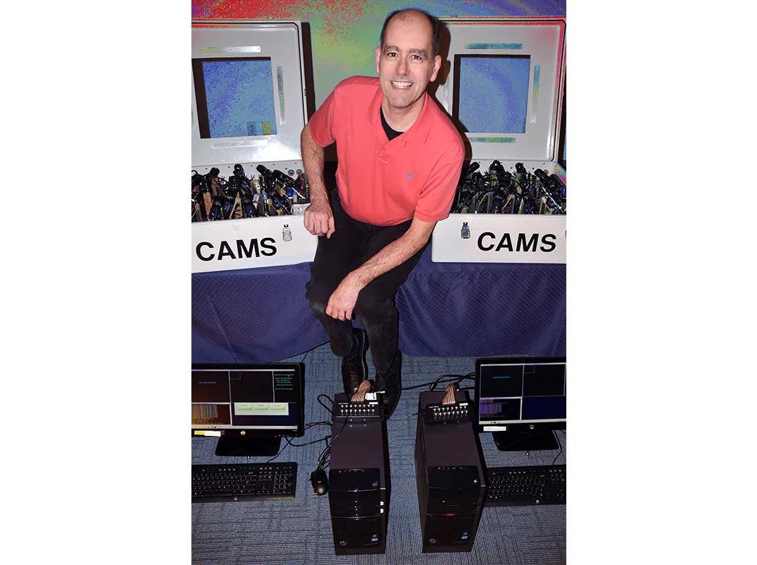
The stations are part of the Cameras for Allsky Meteor Surveillance (CAMS) network, a project founded and run by Jenniskens. The UAE stations, which were established by the Abu Dhabi-based International Astronomical Center, are the most recent to come online; the third and final station started recording two days after the fireball flew overhead. While the network tracks dramatic fireballs and predicts where meteorites may land, its main purpose is to map the meteor showers that appear above us.
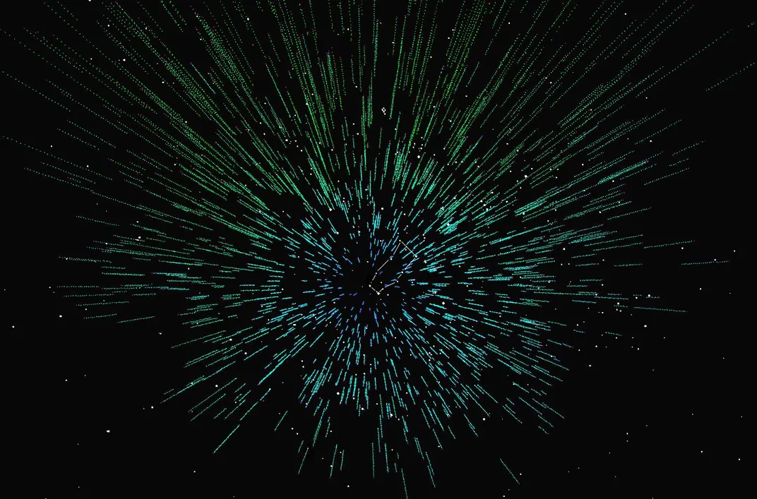
Identifying and tracking the meteor streams that pass near Earth’s orbit requires a global effort. Though each station can only monitor the sky during the local night, astronomers can piece together a complete picture by analyzing the combined data from the entire network. That's important, because mapping meteor showers isn’t just a way of getting to know our neighborhood. It also provides clues to help identify the parent body—the comet or asteroid that spawned the shower—offering researchers a rare glimpse into the earliest history of our solar system.
“It’s really fascinating to see how what happens over our heads is constantly changing. There’s a lot going on near Earth’s orbit,” says Jenniskens. An interactive visualization built from the CAMS data lets users explore this celestial dance, and watch the reconstructed meteor streams moving through the solar system.

As an undergraduate at the University of Leiden, Jenniskens used to go out with friends to track meteors above the Dutch countryside, tracing their route on a star chart with a pencil and ruler. They were interested in the variability of familiar showers such as the Perseids and Orionids, but also in learning about sporadic showers that had sometimes been recorded.
“We noticed that those actually happened, and we heard accounts from other amateur astronomers who saw these unusual showers,” recalls Jenniskens. “They would last only an hour or two and would be quite spectacular, but they would be seen by just two people.”
Predicting these irregular showers was too complicated a problem for the models and computational tools available at the time. Jenniskens set out to prove the existence of sporadic showers and predict their appearance. In 1995, he predicted the return of the sporadic Alpha Monocerotid meteor shower and travelled to Spain to observe the brief outburst, confirming his prediction.
However, building a full picture of our home’s celestial neighborhood calls for more than predicting sporadic meteor showers. Ideally, a map of meteor showers would be built up by continuously recording the night sky. And that wasn’t possible until early this century, when video surveillance cameras became sensitive enough to record the stars that are visible to the naked eye.
“If you can film the stars that you can see with the naked eye, then you can also film meteors,” explains Jenniskens. With help from astronomer Peter Gural, who developed algorithms to detect meteors in the video records, Jenniskens deployed the first CAMS network in California in 2010.
The California network consisted of three stations spaced apart to make triangulation possible; each station housed 20 cameras to give full-sky coverage. While the 60-camera network was an excellent tool for recording and tracking meteors, it suffered from one significant drawback: It isn’t always night in California. Sporadic meteor showers can be quite brief, and if one happened while the California network was covered by clouds or blinded by sunlight, there would be no record of it. The only solution was to expand the CAMS network by deploying more stations around the world.
“The idea was to do everything we could to make it possible for the network to grow, for more cameras to be deployed,” says Jenniskens. Instructions for setting up a CAMS station are available on the website, and the project also provides the necessary software and helps set it up. Since 2010, the network has been steadily growing. The California network grew to 80 cameras, and new networks were established in Arizona, Florida, and on the North Atlantic coast.
Later, the project went global, with a network in the Benelux countries, another in New Zealand, and finally the latest addition in the UAE.

With stations distributed around the globe, the CAMS network has a much better chance of catching sporadic showers. The UAE and California are precisely 12 time zones apart, meaning the network has full nighttime coverage during the northern hemisphere’s winter. The local networks can also serve as hubs for research and outreach; Mohammad Odeh, the director of the International Astronomical Center, is planning to give talks about the project in the next year and would like to see local institutes work with the data from the UAE network.
Jenniskens hopes the network will expand to include more stations in the southern hemisphere, filling the coverage gap during the northern hemisphere’s summer; at the moment, he is contacting potential partners in several southern hemisphere country. Broader global coverage has already paid dividends: In 2015, the New Zealand station picked up an unexpected shower that peaked during the New Year’s Eve celebration, peppering the fireworks with naked-eye meteors.
Tracking meteor showers enables the researchers to trace the orbit of the parent comet or asteroid, which passes fairly close to Earth’s orbit. “Astronomers are mapping the large-scale structure of the universe, but the meteor mapping effort is very close to us, very near to Earth,” says Jenniskens. “It’s really fascinating, and it’s only now coming into view.” Not only does this help astronomers learn about the history of the solar system, but it can also provide more information about the properties of near-Earth asteroids.
Occasionally, a larger meteoroid will burn through the atmosphere as a brilliant fireball before fragmenting and sending meteorites down to the surface. These meteorites rarely cause significant damage, but they do carry a snapshot of the solar system’s history down to our planet’s surface. The composition of recovered fragments, together with their reconstructed orbit, give researchers information about the parent bodies and the debris fields they come from.
With data from the CAMS network, astronomers can roughly predict the meteorites’ landing site and outline a search area. The UAE fireball was predicted to have sent down meteorites a few centimeters in size, so Mohammad Odeh took a team hunting for them.
Unfortunately, the predicted landing area included a demolition site, as well as a mall, a port and a restricted zone. “We easily found 2 or 3 thousand small black stones in the area,” says Odeh. “There were mountains of small black stones, and it was impractical to continue the search.” Despite turning up empty-handed, Odeh calls the search a learning experience for the UAE team—so that they'll be better prepared the next time a piece of the solar system falls to Earth.