What Geology Has to Say About Building a 1,000-Mile Border Wall
Compared to erecting a marble palace or high-steepled church, a wall may seem relatively straightforward—it isn’t
/https://tf-cmsv2-smithsonianmag-media.s3.amazonaws.com/filer/1a/ee/1aee3837-b9ab-498c-a0c8-d9391b9250c4/f54pr8.jpg)
Last month, President Donald Trump took steps to make good on a campaign promise to turn the United States’ existing border fence into a "big, beautiful" wall. On January 25, the White House issued an Executive Order announcing the creation of a “secure, contiguous, and impassable physical barrier … to prevent illegal immigration, drug and human trafficking, and acts of terrorism.” Now the U.S. Customs and Border Protection—the office tasked with enforcing border regulations—is scrambling to make that order a concrete reality.
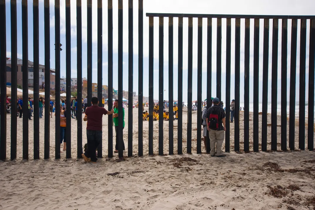
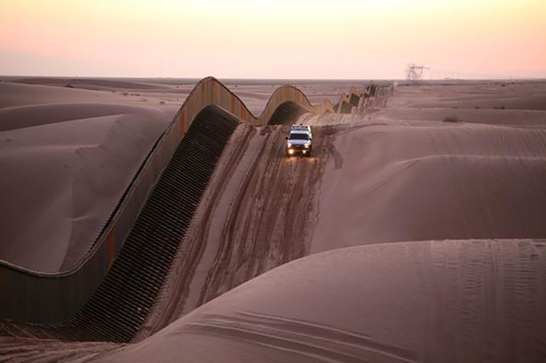
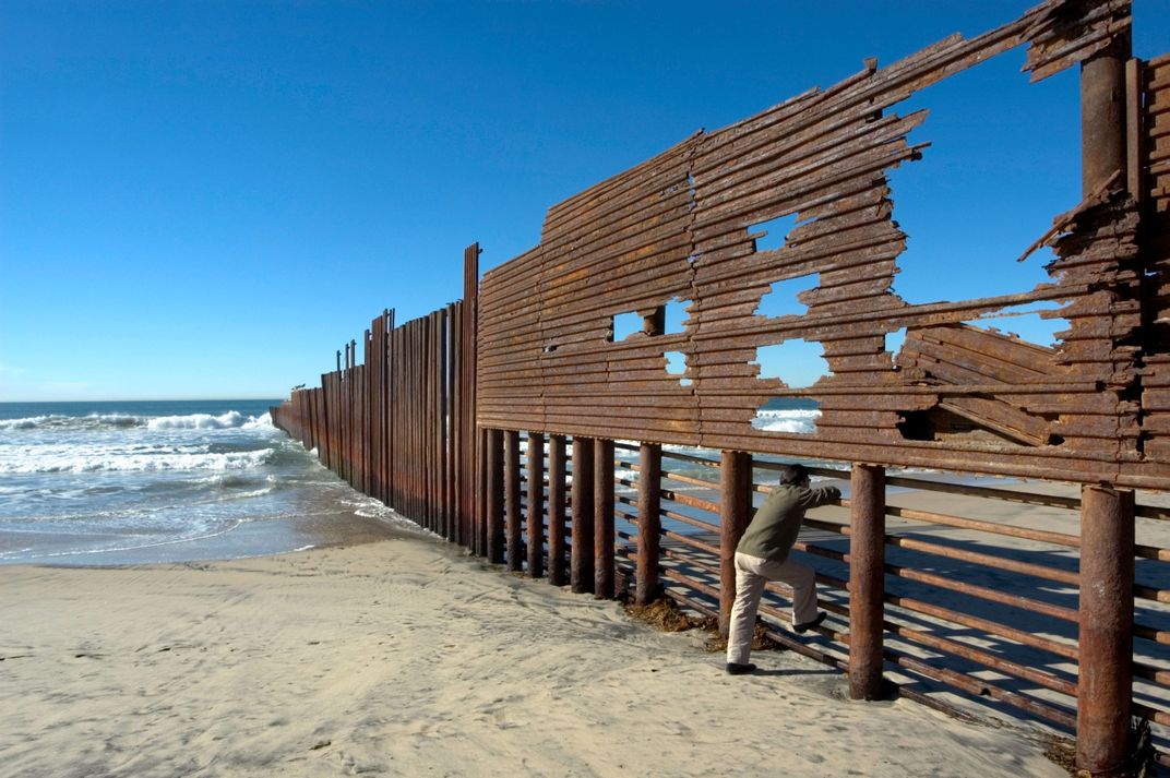
Today’s fence consists of roughly 650 miles of disparate segments, made out of a combination of steel posts and rails, metal sheeting, chain link, concrete vehicle barriers and wire mesh. To replace that fence with what has been described as a 20- to 50-foot concrete structure that will traverse 1,000 of the some 2,000 miles of the U.S.’s border with Mexico will be no easy feat. Besides dealing with a proposed Mexican lawsuit and navigating the private ownership of much of Texas’ lands, there is another concern few have addressed in detail: geology.
Compared to building a marble palace or high-steepled church, erecting a wall may seem relatively straightforward. It isn’t. (Just ask the Chinese, whose Great Wall took 2,000 years to build and failed to keep out invaders.) Though most wall designs are fairly simple, builders must adapt to a wide range of terrains, explains Gary Clendenin, a senior hydrogeologist at ICF. The southern U.S. border alone contains desert, wetlands, grasslands, rivers, mountains and forests—all of which create vastly different problems for builders.
“The length of this thing presents challenges that just aren’t typically undertaken in a construction project,” says Clendenin.
Can these hurdles be overcome? Smithsonian.com asked two scientists, a geophysicist and a hydrogeologist, which geologic factors the wall’s builders should take into account first if they are to execute this ambitious project.

Surveying the Situation
The Tower of Pisa was never meant to lean. Built between 1173 and 1370, the off-kilter structure was positioned atop roughly 30 feet of fine river sediments underlain by a layer of ancient marine clay. But as builders assembled the tons of marble, the river sediments didn’t compact evenly. So by 1178, when they had finished work on the third story, the tower had already acquired its characteristic tilt.
The Italian government has since spent millions of dollars to make sure this beloved landmark doesn't topple over. Such structural failures serve as a reminder that, while our ancestors did manage to successfully erect many impressive feats, “they don’t necessarily stay upright,” in the words of field geophysicist Mika McKinnon. To circumvent such problems today, modern builders have added a crucial step to the construction process: surveying. Though time-consuming, this step is critical to ensure that the resulting structure can remain standing on terra firma for years to come.
Before a single brick is laid, teams of scientists assemble on scene to investigate a litany of details, from bedrock depth to soil chemistry. In the case of the border wall, they would have to traverse the entire length of the proposed path, working in segments to evaluate the region, collect data, develop plans. (This necessity makes the process of erecting walls—especially ones spanning thousands of miles—more challenging than building, say, a 95-story skyscraper.)
“Quite frankly, that would take years to do,” says Clendenin, who specializes in linear projects like railways and roads. McKinnon agrees. One project she worked on, a three-mile stretch of pipeline, is now on year five of field surveys.
Yet Trump’s order appears to allow a mere six months for all surveying and planning efforts. Within its long list of required steps, his executive order states:
“Produce a comprehensive study of the security of the southern border, to be completed within 180 days of this order, that shall include the current state of southern border security, all geophysical and topographical aspects of the southern border, the availability of Federal and State resources necessary to achieve complete operational control of the southern border, and a strategy to obtain and maintain complete operational control of the southern border.”
When contacted by Smithsonian.com, the Customs and Border Protection agency declined to comment on the current timeline for the wall, saying in an email that "it would be speculative to address the questions that you're asking at this point.” But according to scientists Smithsonian.com spoke to, it isn’t going up anytime soon.
…
Getting to Bedrock
The prehistoric city of Petra stands as a prime example of ancient geologic foresight. Around the 4th century BC, Petra’s inhabitants carved the basis for this once-bustling trading city directly into the rugged pink and tan sandstone cliffs between the Red Sea and the Dead sea. Though winds and rain threatened to erode the structure top down, its firm rooting in bedrock—the solid rock that lies beneath the earth’s loose layers—has kept this structure standing tall for thousands of years.
Such grounding in bedrock is a key feature when building a megastructure, says McKinnon. For something as extensive as a 1,000-mile wall that stands upwards of 20 feet tall, builders will need to anchor the whole thing beneath the surface to the underlying rock if they want it to stay upright.
The problem is, getting to bedrock can be a doozy. Great swaths of the border feature a hefty layer of loose sediments—dirt, soils, sand—laying atop the bedrock. In some regions the bedrock is hundreds if not thousands of feet down. “Some places the bedrock will be too deep—you'll never be able to reach the bedrock in an affordable fashion,” says McKinnon.
“That's okay if you want to [build] a tiny house because you just have it floating on its foundation,” she adds.
But if you’re building a megastructure, “you have a problem,” she says.

That’s not to say that building on sand is impossible. But to safely erect such structures, geophysicists today conduct extensive seismic surveys to image what lies beneath. To create these pictures, they install rows of spike-like geophones, which are 3D microphones that detect minute vibrations of the ground, converting them into an electric signal. Then they make a large noise, often by triggering an explosion or using a heavy weight to thump the ground. The geophones record the scattering and reflection of vibrations to image underground structures, and tease out problems that may lay under the surface.
McKinnon experienced one of these problems firsthand, during the construction of a hydroelectric dam that was meant to be built across a valley that spanned about a mile. The team did all the proper surveys of the region, and discovered that beneath their riverbed lay a second channel buried in dirt. “If we hadn't found it and we tried to build our dam across, then the water would have just eroded that old channel underneath and we would have had a river under our dam,” she says.
There are two options for overcoming such problems with sediment: compact the sediment and add a deeper foundation. For a wall roughly 20 feet tall, the foundation should extend six to eight feet beneath the surface, Clendenin says. All of these steps are expensive and time-consuming. But skimp on any of them, and "you get your Leaning-Tower-of-Pisa situation," says McKinnon.
Of course, many modern regions don’t have the economic resources to do such surveys and construction of deep foundations. The cities of Campania, Italy, are built atop loose sediments that are prone to sliding—a situation worsened by local clearcutting of the vegetation and unregulated construction that commonly lacks adequate foundations. These factors leave them vulnerable to the whims of their region’s geology: In 1998, when a mudslide rippled through the city, the houses crumpled under the weight and movement of the sludge, leaving at least 95 dead.
...
Dirt Drama
“Something there is that doesn't love a wall / That sends the frozen-ground-swell under it,” begins Robert Frost’s poem "Mending Wall." Frost may not have been a geological surveyor, but he got one thing right: When it comes to building walls, soil swelling is a major headache. That’s why, after surveyors finish assessing the kind of rock and earth they’ll be building over, they start studying the dirt.
Sediments, particularly in clay-rich materials, can take on water, swelling like a sponge in a bowl of water. The resulting cycles of swelling and shrinking during wet and dry periods can crack the very foundation of structures. And these types of soils are common in many states where the border wall will be built, including Texas and parts of New Mexico. In fact, about half of American homes are built on soils that expand significantly, and nearly half of those suffer damage yearly because of the soil, according to the American Society of Civil Engineers.
Dirt can also eat up the wall’s support system. Soils that are naturally acidic or have high chloride levels can rapidly degrade iron-rich metals, says McKinnon. These soils could “corrode any, say, nice big metal rebar that you're putting in there to stabilize your foundation,” she says. Other soils have a high amount of sulfates, a compound found in the common mineral gypsum that breaks down both metals and concrete. Sulfate-rich soils are common in what’s known as the Trans-Pecos soils along the border in the southwestern arm of Texas.

“You're going to encounter hundreds, if not thousands, of different types of soils along [such a lengthy] linear pathway,” says Clendenin. (In fact, there are over 1,300 kinds of soil in Texas alone.) And many of those soils aren’t going to be the right type to build on top of. At that point, would-be wall-builders have two options: Spend more time and money excavating the existing soils and replacing them with better dirt—or avoid the region altogether.
One thing they can’t always avoid, though, are regions at risk of earthquakes and floods. Rivers run along a sizeable portion of the U.S.-Mexico border, which can create a very real danger of flood. Building adjacent to rivers can also present unexpected legal issues: A 1970 treaty necessitates that the fence be set back from the Rio Grande river, which delineates the Texas-Mexico border. Because of this, the current fence crosscuts Texas landowner’s property and has gaps to allow landowners to pass.
Earthquakes are also relatively common in the western U.S. Depending on the build, some of these tremblors could cause cracks or breaks in the wall, says McKinnon. One example is the magnitude 7.2 quake that struck in 2010 near the California-Mexico Border, according to Austin Elliott, a postdoctoral student at the University of Oxford whose research is focused on the history of earthquakes. “If there had been a wall at El Centinela [a mountain in northern Mexico] it would have been offset,” Elliott writes on Twitter.
…
Even if all the proper surveys are completed and the boxes checked, success isn’t guaranteed. “There are just so many things that have to be done before you even shovel out the first scoop of dirt,” says Clendenin.
Despite all of our modern surveying tools and careful planning, the earth will still surprise you, adds McKinnon. “This part that you thought was boring and simple and easy to predict is actually totally complicated,” she says. “Look at any major excavation for a subway system, any major bridge construction, any large tower complex; all of them had intense surveys beforehand, extensive design phases, and still had to modify while building.”
After the announcement of Trump’s Executive Order, McKinnon took to Twitter to leave a foreboding reminder of the consequences of underestimating the Earth. “Earth doesn’t forgive sloppy,” she wrote. She added in an interview: “Ignore geology at your peril.”
/https://tf-cmsv2-smithsonianmag-media.s3.amazonaws.com/accounts/headshot/Wei-Haas_Maya_Headshot-v2.png)
/https://tf-cmsv2-smithsonianmag-media.s3.amazonaws.com/accounts/headshot/Wei-Haas_Maya_Headshot-v2.png)