New Images Capture Pluto’s Mountains, Badlands and Craters in Breathtaking Detail
These images are “the best close-ups of Pluto that humans may see for decades,” according to NASA
/https://tf-cmsv2-smithsonianmag-media.s3.amazonaws.com/filer/fb/ca/fbcadfe4-e68c-4764-b2fd-99e9de2e91a2/nh-mountainousshorline_0_1.jpg)
Many denizens of Earth fell in love with the distant dwarf planet when the first images came back this summer showing Pluto’s 'heart.' That affection and intrigue has only deepened as more images and data have streamed back from the New Horizons probe—revealing prominent mountains, melted plains, dunes and ice volcanoes.
The spacecraft has sped past Pluto, but it is still sending messages about the dwarf planet. This new mosaic of images comes from the New Horizons’ flyby on July 14, 2015, and show the diversity of features on Pluto’s surface in the closest detail yet.
"[W]e continue to be amazed by what we see," says John Grunsfeld, associate administrator for NASA’s Science Mission Directorate, according to a press release. The image sequence carves out a 50-mile-wide strip across the face of the dwarf planet, a world three billion miles away.
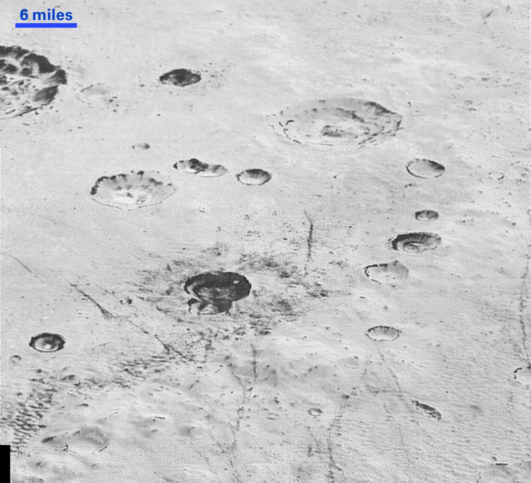
The pictures were captured at a resolution of 250 to 280 feet per pixel, reports Deborah Netburn for The Los Angeles Times. That’s sharp enough to "make out features that are less than half the size of a city block," she adds.
A video scrolling through the mosaic of pictures starts on Pluto’s limb, where the pale cragginess of its plains, pocked with darker craters stands out agains the blackness of surrounding space.
"Impact craters are nature's drill rigs, and the new, highest-resolution pictures of the bigger craters seem to show that Pluto's icy crust, at least in places, is distinctly layered," say deputy lead of the New Horizons Geology, Geophysics and Imaging team William McKinnon in the press release. "Looking into Pluto’s depths is looking back into geologic time, which will help us piece together Pluto's geological history."
NASA researchers are still teasing through data to determine if those layers tell the geological story of an event that happened locally, regionally or globally.

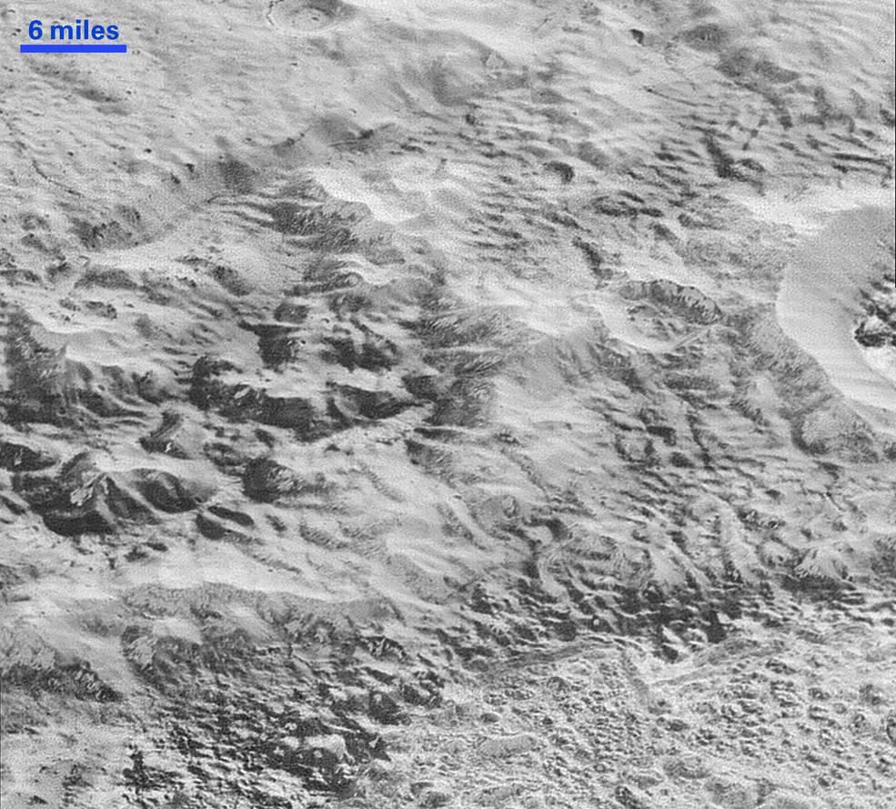
The view then morphs to that of Pluto’s 'Badlands,' where erosion and fault lines carve through the surface. The badlands rise up into a mountainous region that has been informally named the al-Idrisi mountains. The crags jut against the shores of Sputnik Planum, the icy plane that appears covered in wave-like textures, which could be a result of the ice sublimating, Netburn writes.

Where the mountains meet the plain is a particularly striking part of the image sequence (picture at top). The "crumpled ridges in the rubbly material" that surrounds several of the mountains in these new images support the idea that the mountains are just "huge ice blocks that have been jostled and tumbled and somehow transported to their present locations," New Horizon's scientist John Spencer says in the press release.
NASA’s New Horizon’s spacecraft dipped down to just 10,000 miles from Pluto. The telescopic Long Range Reconnaissance Imager took about a minute to gather the images, according to the press release. NASA released the highest resolution possible for the mosaic in in a clickable, zoomable version here.
The stunning resolution of the images also showcases how far robotic space exploration technology has come. “Nothing of this quality was available for Venus or Mars until decades after their first flybys; yet at Pluto we’re there already—down among the craters, mountains and ice fields—less than five months after flyby!" New Horizons principal investigator Alan Stern says in the press release. "The science we can do with these images is simply unbelievable."

