‘Staggering’ Damage to Florida’s Everglades Remains in the Wake of Hurricane Irma
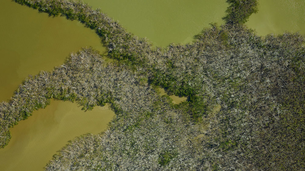
Researchers found gaps in 40 percent of the forest canopy in aerial images taken before and after the storm

In September of last year, as Hurricane Irma tore through the southern United States, fierce winds battered the Florida’s Everglades National Park. As Megan Gannon reports for Live Science, NASA scientists recently conducted an aerial survey of the Everglades to assess the impact of the storm—and found massive damage to the region's mangrove forests.
The research team was able to get a particularly good sense of forest casualties because in April of last year, several months before the storm hit, NASA surveyed the area using an airborne instrument called G-LiHT, which stands for Goddard’s Lidar, Hyperspectral and Thermal Imager. This device maps terrestrial ecosystems using thermal measurements, imaging spectroscopy and a remote sensing technique known as LiDAR. By sending out up to 500,000 laser pulses per second, LiDAR can create detailed 3-D maps of dense forested areas from far above the ground.
As NASA explains on its website, the goal of the 2017 project was to find out how freshwater ecosystems—like the marshes of the Everglades—are transitioning to saltwater ecosystems due to rising sea levels and coastal erosion. By comparing images from this dataset to information gleaned from the most recent aerial survey, researchers were able to assess how the Everglades changed after Irma.
The team returned to the area in December of this year, flying the same path across 500 square miles of wetlands and supplementing that information with 3D scans taken from the ground by local agencies. Researchers discovered that 60 percent of the area’s mangrove forests were severely damaged. Heavy winds had sliced off the limbs of trees and torn them out of the ground, creating gaps across 40 percent of the forest canopy in the surveyed area. The average height of the canopy dropped between three to five feet due to fallen trees and branches.
“It’s staggering how much was lost,” Lola Fatoyinbo, a remote sensing scientist at NASA’s Goddard Space Flight Center, said in the agency’s statement. “The question is, which areas will regrow and which areas won’t.”
The team plans to compare datasets from before and after the storm to see if areas that were under stress prior to Irma recover as quickly as ones that were not. As Maddie Stone explains in Earther, it is important to track the health of this ecosystem because the Everglades act as a buffer that protects residents of south Florida from storms and rising sea levels. “If the Glades are being weakened and lost by natural disasters, development and climate change,” Stone writes, “that’s bad news for the nearly seven million people living nearby.”
NASA researchers are now heading to Puerto Rico to conduct G-LiHT flights over areas that were hit hard by both Irma and Hurricane Maria last year.
“It’s a good way to document which areas were more susceptible to events like Hurricane Maria,” Bruce Cook, G-LiHT lead scientist at NASA Goddard. “And also it’s a way to start tracking recovery as well. A lot of people are interested in the recovery, and what we might be talking about in terms of reestablishing the forests in the future, and whether it will require human intervention.”