How to Start a Hurricane
What makes one small eddy fizzle out, and another turn into the planet’s most destructive storm?
:focal(848x257:849x258)/https://tf-cmsv2-smithsonianmag-media.s3.amazonaws.com/filer/18/f8/18f83b6b-16dc-47a6-ad6c-be9c7397dcf8/06c_aug2015_openerhawktropicalstormfrank_live.jpg)
John Farrar, a Harvard scientist who in 1815 witnessed one of the rare hurricanes to hit New England, wrote about the storm with a simplicity and wonder that reveal just how little was known about the phenomenon at the time. “I have not been able to find the centre or the limits of this tempest,” he wrote. “It was very violent at places separated by a considerable interval from each other, while the intermediate region suffered much less…. In these cases it appears to have been a moving vortex, and not the rushing forward of the great body of the atmosphere.”
Two centuries later, the mature hurricane is a relatively well understood phenomenon. For one thing, it’s one of the most stable structures in the atmosphere. A big tropical storm feeds on a continuous positive feedback loop, a heat engine that moves water and energy from the warm oceans into the atmosphere and back in an easily observable cycle. Prevailing wind patterns make a storm’s track relatively easy to predict, and with every improvement in observation technology and computing power, predictions are only getting better. Hurricane meteorology today is a far cry from the wide-eyed observations of John Farrar.
The thing is, scientists still don’t know exactly how hurricanes form. They don’t understand why, no matter how ripe the conditions, hurricane formation is actually very rare. Only about 20 percent of the disturbances that look like they might spawn hurricanes do. Ed Zipser, a meteorologist at the University of Utah who has been probing and dissecting tropical cyclones for more than 50 years, puts it best: “A hurricane is an absolutely, beautifully smooth-running engine with a very temperamental starter motor.”
That starter motor, what meteorologists call cyclogenesis, is the difference between a storm that becomes a full-blown hurricane and one that fizzles. While finding the catalyst for cyclogenesis is one of the biggest challenges in modern atmospheric science, scientists at least have a basic understanding of its requirements.
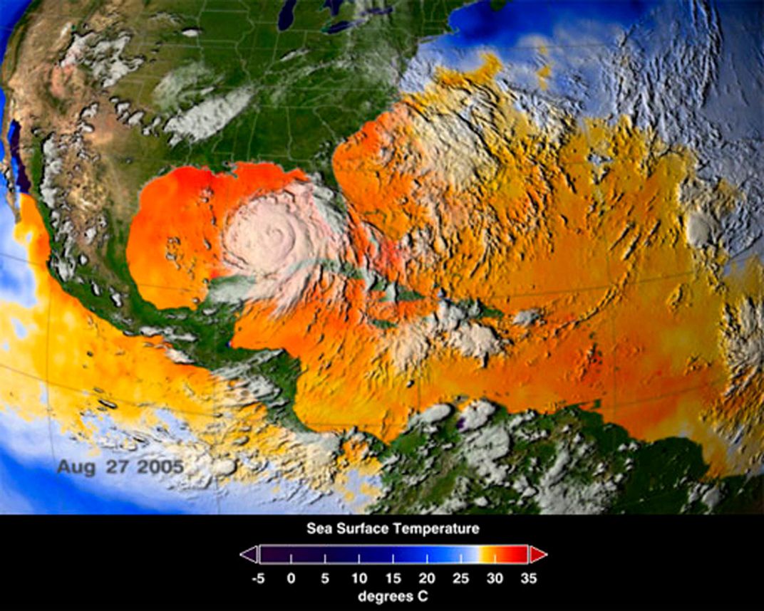
Warm ocean water is vital—at least 80 degrees Fahrenheit. Colder water would rob the storm of energy even as it tried to get going. Energy is the key to all weather, and it moves and changes form most spectacularly in large storms. The very first step in the life of a hurricane is amazingly simple, and happens on a scale too small to see with the naked eye. Water at the surface evaporates, condenses, and falls, ultimately, as rain—the familiar water cycle we learned in elementary school (see “Evaporation–Condensation–Precipitation,” below).
Over the tropical ocean, this cycle happens across vast areas simultaneously—thunderstorms growing up and exhausting themselves in little puffs of convection like bubbles rising from the bottom of a pot of boiling water.
At larger scales, other forces come into play. Some patches of ocean develop more thunderstorms than others, and in those places the air contains more water vapor, which traps more of the heat radiating from the surface—the greenhouse effect. This creates a positive feedback loop that excites more evaporation and convection, which in turn creates a general updraft of warm air that’s more energetic than the spotty, temporary rising at individual locations.
It used to be that only sailors or islanders would observe these convective gatherings. In the mid-19th century, with the advent of weather observing stations around the Atlantic and the contemporary invention of the telegraph, data collected over vast areas could be transmitted and combined in near-real time, enabling scientists to see patterns in pre-hurricane weather and track storms as they moved. Once they saw the big picture, meteorologists began noticing that storms on the verge of becoming tropical cyclones undergo a distinct change: they start to become organized. All the little thunderstorms are no longer isolated. They’re now working together as one storm, feeding themselves through a collective circulation that roars to life like an engine.
In a sense, we owe much of our knowledge of a hurricane’s structure to the personal bravado of a U.S. Army Air Forces pilot named Joseph Duckworth. Up until World War II, hurricane data was limited to whatever could be observed at fixed weather stations and by ships that happened to be in a storm’s path, and scientists didn’t know much about the internal structure of storms. Duckworth was known as a skilled instrument flier, and in July 1943 he was training British pilots at Bryan Field in Texas when a small but intense hurricane began brewing off the Gulf Coast. Duckworth had heard the Brits complaining about the AT-6 Texan they were training in, so to show them what the airplane could do with a skilled pilot, he took off and flew straight into the eye of the hurricane and returned without a scratch. The field’s weather officer asked Duckworth to fly him into the storm as well, so he did. In the process, Duckworth founded the now essential practice of studying hurricanes from within.
A year later, the Great Atlantic Hurricane of 1944 pounded the Eastern Seaboard, and military technicians operating the still-fledgling technology of radar became the first to see the ghostly image of a hurricane’s spiraling arms on their screens. It wasn’t long before meteorologists were using radar to track and study storms, even putting miniature radar instruments on the airplanes that now flew regularly into the eyes of hurricanes.
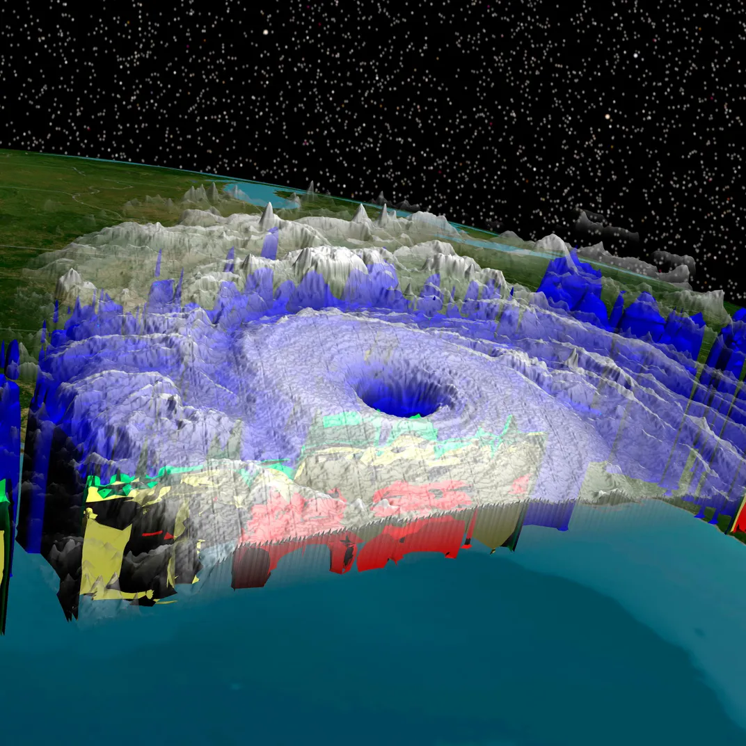
But the real coup came in 1960, when the TIROS weather satellite was launched and humankind got its first wide-angle picture of weather on Earth. Satellites are the ultimate tool for meeting the first challenge of hurricane study: observing them at their full scale. They’re also key to studying cyclogenesis. A hurricane hitting Florida may have traveled thousands of miles, and with repeated images taken from space, meteorologists can simply rewind the movie and look for patterns that tell of the hurricane’s origins.
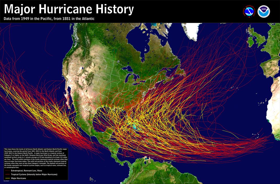
Scrubbing through any such timeline, you’ll see that the majority of hurricanes that hit the United States originate in a broad area stretching from the Leeward Islands to Africa. This phenomenon was first described in 1940 by meteorologist Gordon Dunn, who was analyzing wind flow patterns over the tropics when he noticed a steady parade of low-pressure systems that move across the Atlantic from Africa in periodic waves. These “African easterly waves” tended to be associated with inclement weather, and Dunn observed that they occasionally developed into hurricanes. In fact, 60 percent of tropical cyclones in the north Atlantic are associated with easterly waves, which are caused by dips in the east-blowing African jetstream. They provide just the catalyst Atlantic storms need to tip the thermodynamic scales and kick off a hurricane. Dunn had pinpointed the nursery where some of the most intense Atlantic storms are born.
Satellite imagery shows that Hurricane Katrina began as an easterly wave, though it didn’t turn into a hurricane until it had almost reached Florida. Hugo (1989), Andrew (1992), Floyd (1999), Isabel (2003), Ivan (2004), Frances (2004), and Ike (2008) all started as waves. But not all waves become hurricanes, even when the conditions are perfect. Says Kerry Emanuel of the Massachusetts Institute of Technology, one of the leading theorists studying hurricane formation, “Most of them just happily die in the Atlantic.” There’s something else to the ignition of a hurricane’s engine (see “A Self-Sustaining Heat Engine" in the photo bessay below), and meteorologists are throwing every technology they have at this mystery.
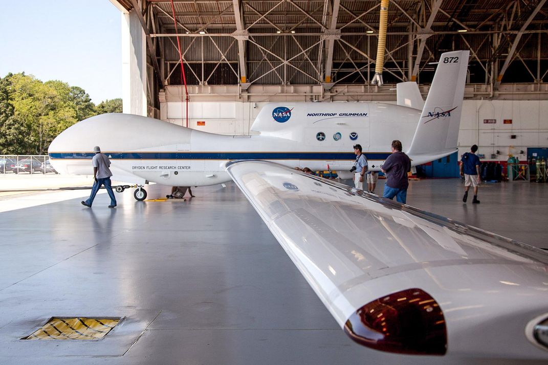
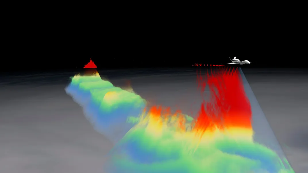
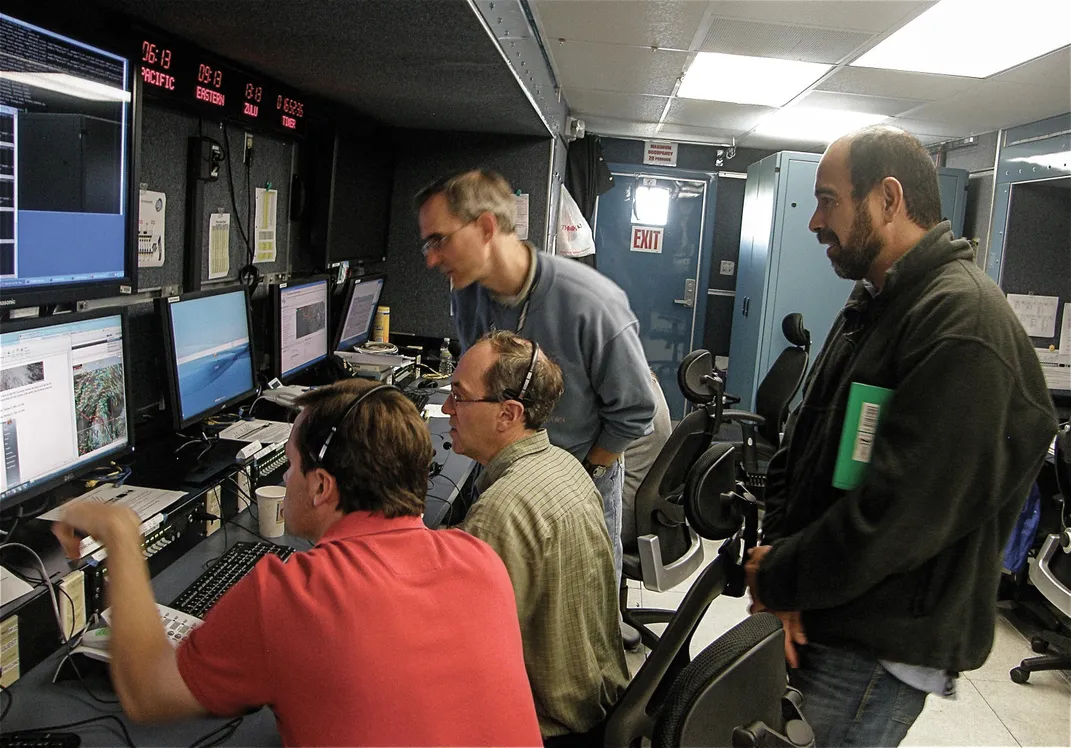
During the past three hurricane seasons, a large and diverse group of scientists have searched for answers to cyclogenesis and other mysteries as part of an ambitious NASA mission called Hurricane and Severe Storm Sentinel, or HS3. The stars of the project were two unmanned Global Hawk drones, launched from NASA’s Wallops Flight Facility in Virginia to where no storm chaser had gone before. One of the remotely piloted aircraft flew above the hurricanes, where it could measure rainfall, humidity, wind speed, and other factors throughout the entire 46,000-foot height of the storm. The other flew around the outside of each storm, using Lidar and a kind of temperature gauge called a scanning high-resolution interferometer sounder to observe conditions that help or hurt the storm’s formation and intensification. In addition to the onboard instruments, the over-the-storm aircraft deployed dropsondes, small instrument packages that drift down under parachutes, taking pressure, temperature, humidity, and wind measurements throughout a storm’s vertical cross section.
The Global Hawks fly higher than most aircraft piloted by humans, but—crucially to the study of fickle tropical storms—they can also fly longer. While crewed flights typically stay “on station” at a storm for only four to six hours, the Global Hawks can last for 18, so scientists get a much more comprehensive picture of spin-up processes all over the Atlantic.
Last September, for example, one of the Global Hawks (the other was grounded due to mechanical problems) flew a pair of two-day flights over Hurricane Edouard as the storm was strengthening. Dropsonde data showed low-level warming and drying, indicative of air sinking as the hurricane’s eye formed. Data like this ultimately feed into models that give the scientists a more detailed picture of what’s happening.
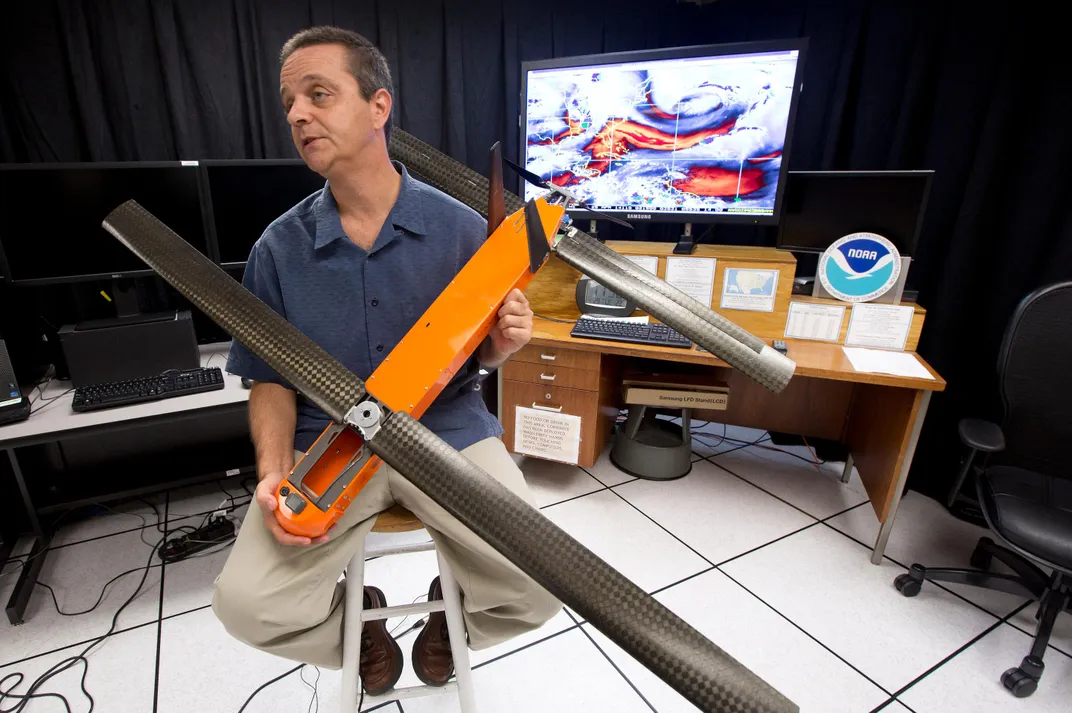
Smaller and cheaper drones have also been brought in on the case. “The Global Hawks are nice,” says Neal Dorst, a meteorologist with the Atlantic Oceanographic and Meteorological Laboratory’s Hurricane Research Division, but they can’t fly into a storm at low altitude without risking going down in the heavy, erratic winds near the ocean surface. A new drone called the Coyote, fielded in cooperation with the Office of Naval Research, is much smaller (it could fit on a desktop) and so cheap it’s essentially expendable, making it cost-effective to fly it in the few thousand feet that make up the critical region where the warm ocean meets the storm.
“This is the area where energy is coming from the ocean into the atmosphere,” says Dorst. “We need the information about how the energy is being transferred, and we really don’t have a clue as to what some of the parameter values are. [The Coyote] will get us actual numbers.” Deployed from a P-3 Orion Hurricane Hunter aircraft much the way dropsondes are, two Coyotes made successful flights into Hurricane Edouard last year. Having proven the drone’s ability to collect low-level data, the scientists are planning more Coyote flights during this year’s summer storm season.
While this data is being digested, hurricane scientists have a few guesses about the key to cyclogenesis. Some think that more lightning in a certain area of a developing storm may signal that the transformation is about to happen, others that huge rockets of convection called hot towers are the place to look.
Also hacking away at the problem of cyclogenesis are theorists like Emanuel, who increasingly are looking at thermodynamics—the roles that heat and energy play in the movements of weather. It’s an area that until recently had been largely glossed over. “We’re bothering to learn pieces of physics that our culture avoided for decades,” Emanuel says, adding that he expects big breakthroughs in our understanding of hurricanes within the next few years.
Even so, the search for cyclogenesis will face a new challenge: The rules that govern hurricanes are changing. Emanuel is one of the prominent meteorologists working on the question of how global climate change will affect hurricane formation and behavior. Much of the change will come with rising sea surface temperatures, which will provide more wind and more rain—fuel for hurricanes. “You’ll start to see hurricanes with wind speeds that you have not seen before, because it wasn’t physically possible,” says Emanuel.
While warming will increase the size and intensity of storms, Emanuel theorizes that it also will make it more difficult for them to form, as it will dry parts of the atmosphere. The result: Fewer storms make it through to the spin-up phase. But once they get going, they’ll be harder to stop. According to Emanuel, we’ll likely see more Category 5 hurricanes—storms with sustained winds of at least 156 mph—than we do now, even with fewer storms spinning up in any given season. Some scientists have even suggested we’ll need a Category 6, for storms with winds of 174 mph and above.
Emanuel’s colleague James Kossin has shown that hurricanes are reaching their peak further from the equator, possibly as a result of a general expansion of the tropical zones. As a result, cities that have never experienced hurricanes may start to be regularly assaulted. To make matters worse, there’s some indication in the models that storms will be larger than they are today (although it’s not yet clear why). So when a storm makes landfall, more of the coastline will be inundated, not just because of rain but also because of the storm surge created by wind traveling over hundreds of miles of ocean. Rising sea level will make the surge risk even greater.
Overall, the future of hurricanes looks pretty scary. Superstorm Sandy wasn’t necessarily a result of climate change, but it may have been the first of many storms to hit a whole coastline of unprepared cities. Given that climate change creates a moving target in terms of computer modeling, with many of the physical factors that determine storm formation about to change over the next century, it won’t be easy for scientists to pin down what exactly we should expect. Time—and an army of drones, dropsondes, daring pilots, and dogged questioners—will tell.
In the meantime, scientists have still not worked out very basic characteristics of hurricane formation. Thinking I’d missed something obvious during our conversation, I asked Emanuel why the rain bands inside hurricanes form the way they do, with such seemingly regular alternation of heavy rain and relatively clear skies. He laughed.
“Wouldn’t we like to know?”
Evaporation-Condensation-Precipitation
/https://tf-cmsv2-smithsonianmag-media.s3.amazonaws.com/filer/38/aa/38aa2d9f-7569-44b9-beda-3ad32475b10d/hurricane-photo-essay-graphic-1-web.jpg)
As the sun heats the ocean, water molecules at the surface jump around in random directions. Some jump up, and if they’re excited enough, they stay up, transferring heat energy from the water to the air. Voilà, evaporation. Because of small variations across the water’s surface, the process is uneven—more evaporates in some places than in others. At each of those spots, there’s a parcel of air that has a higher percentage of water vapor (which is lighter than air) than the air around it. This causes the air to rise in a process called convection.
Some version of this process is happening everywhere, all the time. It’s what makes clouds. The warm, moist air resulting from evaporation rises into lower-pressure air and expands. That costs energy, and the air cools (what’s called adiabatic cooling). The water vapor molecules, now more lethargic, get stuck to tiny dust particles called condensation nuclei, in the process returning to a liquid state, and the result is a cloud. The air within the cloud continues to rise, encountering colder air. More condensation occurs, the condensation nuclei start sticking together and coalescing into droplets, and you get rain. As they fall, the raindrops partially evaporate, which cools the air within the cloud the same way evaporating sweat cools your body.
In a typical thunderstorm, that cool air sinks all the way to the surface and spreads out, what meteorologists call a downburst. Replacing warm surface air with cool air effectively shuts off the convection that created the storm in the first place. The sky clears and it’s over.
A Self-Sustaining Heat Engine
/https://tf-cmsv2-smithsonianmag-media.s3.amazonaws.com/filer/63/e3/63e3eb35-cc56-4995-bd46-a0f4df5d5c13/06f_aug2015_issviewprewinterstorm_live.jpg)
Scientists believe that cyclogenesis has something to do with a disturbance in the area of a nascent storm, something external that acts as a catalyst. Kerry Emanuel of MIT likens a run-of-the-mill batch of tropical thunderstorms to a ball balanced on a hilltop. Little ridges surrounding the ball (pressure gradients that help shut down a normal storm) prevent it from rolling down the slope. But if something gives the ball a sufficient kick to get it over the ridges, away it goes.
The question is what provides the kick. The general idea is that some large weather feature enters the stormy area and forces the moist air inside it to rise en masse. Up until that point, air entering the storm at middle altitudes was drier, so rain falling through the clouds evaporated and cooled the air, creating downdrafts. Now, with the storm region becoming more humid, the air is saturated with water vapor and the raindrops have a harder time evaporating as they fall. The air stays warm, and there are no resulting downdrafts. That in turn leaves nothing to counteract the warm, rising air at the surface. The cycle that normally causes thunderstorms to dissipate has been shut off, and the ball is now rolling downhill with a vengeance.
All that air rising from the surface leaves an enormous vacancy beneath the cluster of storms, which at this stage meteorologists start calling a tropical depression. The vacancy is an area of low pressure near the surface, and the surrounding air tries to even things up and make the pressures equal. If you could stand in many places at once under the developing storm, you would feel a lot of wind now rushing in toward the storm’s core, and you’d get a visceral understanding of the heat engine idea. As the wind blows in toward the center, it removes moist air from directly above any given patch of ocean, increasing evaporation. More evaporation transfers more heat to the system, so you get more rising air and lower pressure at the core. Those changes fuel even stronger winds moving toward the center, which further accelerates evaporation. And so the storm grows.
What Makes It Rotate?
/https://tf-cmsv2-smithsonianmag-media.s3.amazonaws.com/filer/0e/ee/0eee4022-ff76-4da1-a27d-f47904e63316/hurricane-photo-essay-graphic-2.jpg)
As the Great September Gale of 1815 threw boats down the streets of Providence, Rhode Island, John Farrar watched the winds in Boston swing around the compass from northeast to east to south in a matter of a few hours. Records later showed that around the same time in New York, the wind was shifting, too, but in different directions. Farrar deduced that the whole storm must have been rotating, like a giant turntable.
Even now, 200 years later, this phenomenon (what meteorologists call a hurricane’s primary circulation) still looks like magic, because there’s absolutely no force acting to spin the storm. And it is, in a sense, an illusion.
Because Earth is a sphere, the “ground” at the equator, where the planet is fatter, has farther to rotate in the same amount of time than the ground at, say, 40 degrees latitude. The wind bound for the low-pressure center of a tropical storm can travel a long way, as far as 1,000 kilometers (620 miles). Over such a long distance, the rotation of Earth appears to deflect those winds from a straight line into a curve. Scientists and mariners had seen this effect in the trade winds for centuries, but it wasn’t until the early 18th century that a meteorologist, George Hadley, worked out why: The winds don’t just have forward momentum from the atmospheric forces acting on them, they also have lateral momentum in the direction Earth is rotating.
So winds keep curving—to the right in the northern hemisphere and to the left in the southern, until they’re basically traveling in a circle. It’s called the Coriolis effect, after the French mathematician who later described it with an equation. In the case of tropical cyclones, the circling winds are also still traveling inward, so the whole system now looks like a spiral. Because of the curvature of the spiral, a parcel of air moving toward the center takes a longer route, so it travels over more warm seawater and picks up more moisture and heat. This gives the storm more power, making it essentially self-sustaining. When surface winds reach 39 mph, meteorologists start calling the cyclone a tropical storm and give it a first name. If the wind speed increases to 74 mph, according to admittedly arbitrary guidelines, it’s a hurricane.
Eyes and Arms: The Structure of a Hurricane
/https://tf-cmsv2-smithsonianmag-media.s3.amazonaws.com/filer/5f/22/5f22bc05-15ad-4c3b-a918-0435cffcce83/hurricane-photo-essay-graphic-3.jpg)
As the air inside a hurricane warms up, much of the air at the surface rises long before it reaches the core. The resulting clouds drop massive amounts of rain. When the air eventually rises high enough to cool, it sinks back to the surface, where it rejoins the inflow and starts the process all over again.
This is called the storm’s secondary circulation, and produces rings of thunderstorms radiating out from the center—rain bands. Though anyone who’s seen a satellite image of a tropical storm can tell you they don’t look like rings. They look like crazy, spiraling arms.
Wind speed isn’t the same throughout the storm; you’ll usually find the highest winds just shy of the center. The reason is that as the spiral tightens inward, the air moves faster (like a spinning figure skater pulling in her arms, the smaller the radius of the spin, the faster the spin). The strange part is that the actual center often has no wind at all—only calm, blue sky.
The eye of a cyclone is calm because winds rushing to the center can’t converge on a point, so they rise, not just up but way up, shooting out of the top of the storm like an invisible volcano. The place where all that sea-warmed air is forced to rise, where it’s wettest and where the air is moving fastest, is called the eyewall. It’s basically a cylindrical, super-destructive wall of clouds, and it’s the part of the storm that does the most damage when it passes over land.
