El Mirador, the Lost City of the Maya
Now overgrown by jungle, the ancient site was once the thriving capital of the Maya civilization
/https://tf-cmsv2-smithsonianmag-media.s3.amazonaws.com/filer/El-Mirador-La-Danta-631.jpg)
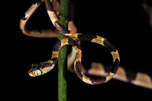
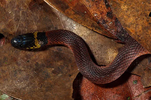
Had we been traveling overland, it would have taken two or three days to get from the end of the road at Carmelita to El Mirador: long hours of punishing heat and drenching rain, of mud and mosquitoes, and the possibility that the jungle novice in our party (that would be me, not the biologists turned photographers Christian Ziegler and Claudio Contreras) might step on a lethal fer-de-lance or do some witless city thing to provoke a jaguar or arouse the ire of the army ants inhabiting the last great swath of subtropical rain forest in Mesoamerica.
Mercifully, Itzamna, the supreme creator god of the ancient Maya, had favored us with a pilot named Guillermo Lozano, who was now easing his maroon-striped Bell helicopter into the air. It was a Sunday morning in northern Guatemala, late October. Next to him up front was the archaeologist Richard Hansen, the director and principal investigator of the Mirador Basin Project. About a half-hour’s flying time due north was the Mirador basin itself—a 2,475-square-mile tract of jungle in northern Guatemala and Campeche, Mexico, filled with hidden ruins that Hansen and others refer to as “the cradle of Maya civilization.”
We zipped away from the town of Flores at 140 knots. Off to the east were the spectacular Maya pyramids and ruins of Tikal National Park, which is now linked to Flores by road and draws between 150,000 and 350,000 visitors a year. We crossed a jungle-covered limestone ridge about 600 feet high. Hansen’s voice crackled over the intercom.
“This is the southern tip of the Mirador basin,” he said. “It’s shaped like a heart. It’s a self-contained ecosystem surrounded by these ridges. There are five kinds of tropical forest down there. Tikal has only two. ”
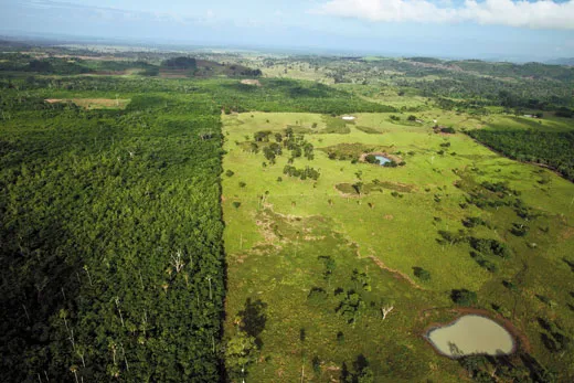
Visible below were clearings in the forest, the smoke of fires, a scattering of cattle, buildings and the occasional road.
“All this has been deforested in the last five years or so,” Hansen said over the roar of the rotor. “Any use of this particular area of forest other than ecotourism would be, to me, the equivalent of using the Grand Canyon for a garbage dump.”
After a few minutes there were no more roads or cows or any other signs of human settlement, just a few swampy open patches called civales breaking the great green quilt formed by the canopies of the 150-foot-tall ramón (breadnut) and sapodilla trees, whose trunks are slashed by skilled laborers known as chicleros for the sap used to make chewing gum. Hansen pointed out some of the sites that he and his colleagues have mapped in the Mirador basin, including the large lost cities of Tintal and Nakbe, which is one of the oldest known Maya settlements, dating from around 1000 to 400 B.C.
“See that there,” he said, pointing to a slightly raised and darker line of trees. “That’s a causeway. There’s a plastered roadbed under there 2 to 6 meters high and 20 to 40 meters wide. A sacbe it’s called—white road. It runs for about 12 kilometers from Mirador to Nakbe. It’s part of the first freeway system in the world.”
Suddenly clouds closed in, and Lozano began to climb, anxiously looking for a break in the skies. A tropical storm (named Richard, appropriately enough) was bearing down on northern Guatemala.
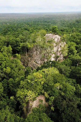
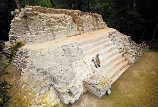
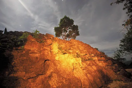
“There!” Hansen said. Lozano banked down toward what looked from afar to be a huge stone knoll, half swallowed in vines and trees. The pilots who first flew over the Mirador basin in the 1930s, among them Charles Lindbergh, were startled to see what they thought were volcanoes rising out of the limestone lowlands. In fact, they were pyramids built more than two millennia ago, and what we were circling was the largest of them all, the crown of the La Danta complex. At 230 feet, it is not as tall as the great pyramid at Giza, but, according to Hansen, it is more massive, containing some 99 million cubic feet of rock and fill.
We were hovering now over the heart of the ancient city of El Mirador, once home to an estimated 200,000 people and the capital of a complex society of interconnected cities and settlements that may have supported upwards of a million people. The last thing you would ever guess from a casual aerial overview was that virtually every topographical contour in the primordial forest was created not by geological and environmental forces but by the vanished inhabitants of one of the world’s foundational civilizations.
“All this was abandoned nearly 2,000 years ago,” Hansen said. “The whole thing developed before Tikal existed. It’s like finding Pompeii.”
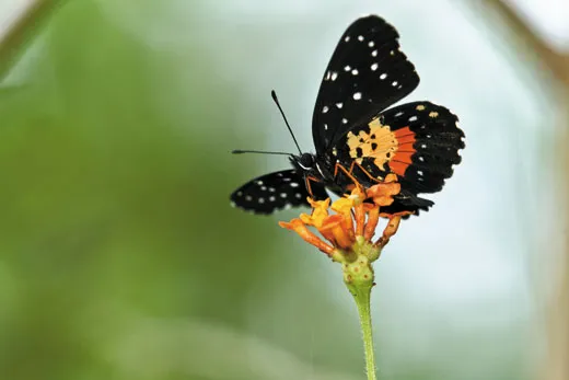
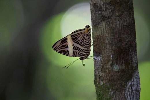
A clearing appeared below us and we fluttered down onto a grassy strip, scattering a delegation of butterflies.
It’s a dedicated archaeologist whose affection for a place increases even after he’s gone into personal debt to keep his research and conservation work going, weathered death threats from irate loggers, had close encounters with fer-de-lances and falling trees, survived a jungle plane crash that nearly killed him, his wife and the oldest of his seven children and incinerated the only copies of his master’s thesis. By the same token it’s a versatile scientist who can enthrall audiences at Hollywood fund-raisers and bargain in flawless Spanish with muleteers hauling sacks of specially formulated Preclassic Maya mortar.
“To do this you have to be a jack-of-all-trades or an absolute idiot,” said Hansen as we sat around that first evening on the long log-and-plank benches of the dining hall, an open-sided barnlike structure with a translucent plastic roof and special gutters that funnel rainwater into a 25,000- gallon cistern. Hansen was wearing a tan cap, a grungy off-white cotton shirt and stained off-white cotton pants—light-colored fabrics make it easier to see which exotic insects might be trying to attach themselves to flesh. (I was immediately regretting my choice of dark gray trousers.)
During the Mirador field-research season, which runs from May to September, there are as many as 350 people in the camp, including scientists from some 52 universities and institutions. The archaeological work could proceed year-round but Hansen spends the off-months raising money (with the goal of maintaining a minimum annual budget ofabout $2.5 million) and preparing publications (now up to 177). He also teaches at Idaho State University in Pocatello, where he is an assistant professor in the department of anthropology and the senior scientist at the university’s Institute for Mesoamerican Research.
“If I had five minutes for every hour I’ve spent chasing dollars, I’d have another 50 publications,” he said with a sigh.
There was only a skeletal crew of workmen on hand now, along with guards Hansen had employed to ward off looters, and the camp cook, Dominga Soberanis, a short, powerfully built Maya woman who had fixed us all a supper of fried chicken and black beans on a steel sheet over a wood fire. Fresh tomatoes had come in on the helicopter, and there were pitchers of rice milk and tea brewed from the leaves of the allspice tree that grew in the ramón forest.
That afternoon, after Christian had amused himself at my expense by crying “Snake!” while fumbling in feigned horror with what looked like a fer-de-lance but proved to be a brown stick, Hansen had shown us around the camp. Tent sites, storage magazines, screening tables, a well-equipped research building adjacent to the dining hall and guest bungalows where we had stashed our gear were linked by a web of root-riddled trails. Hansen was billeted in a bungalow that also served as his office. By some modern shamanism, it had Internet access.
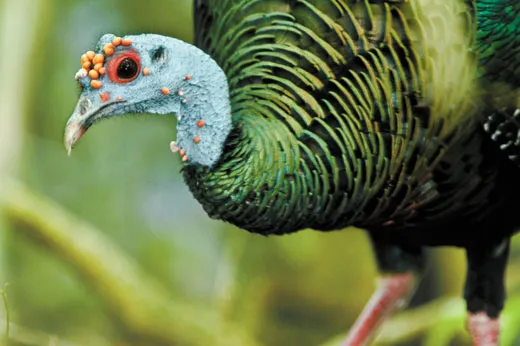
We wandered out to the old helicopter landing strip where campsites had been established for tourists. Some 2,000 to 3,000 visitors a year either make the trek in from Carmelita or fly in by helicopter from Flores. Rangers stationed in the area were feeding an orphaned baby spider monkey creamed corn; dozens of ocellated turkeys—beautiful iridescent birds found only on the Yucatán Peninsula—were pecking at the grass. Meleagris ocellata is among the most photogenic of the 184 bird species recorded to date in the basin, which is also a key stopover for many migratory birds that travel the flyways of the eastern United States. The turkeys scrambled for cover under the trees when a pair of brown jays cried out. Their jay-dar had spotted a raptor overhead—possibly an ornate hawk-eagle (Spizaetus ornatus).
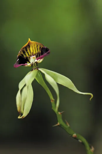
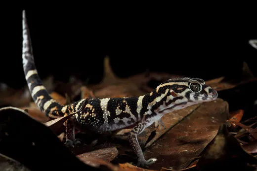
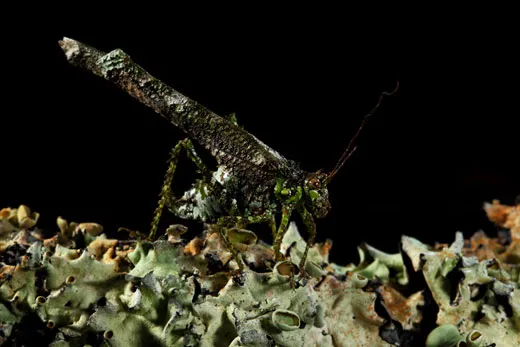
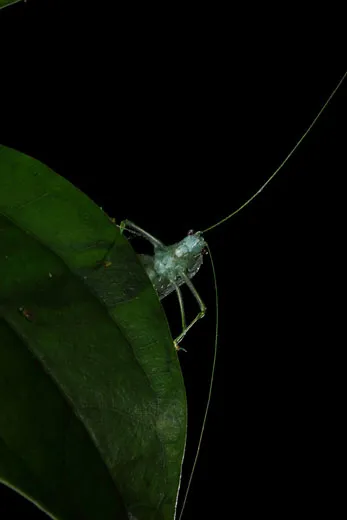
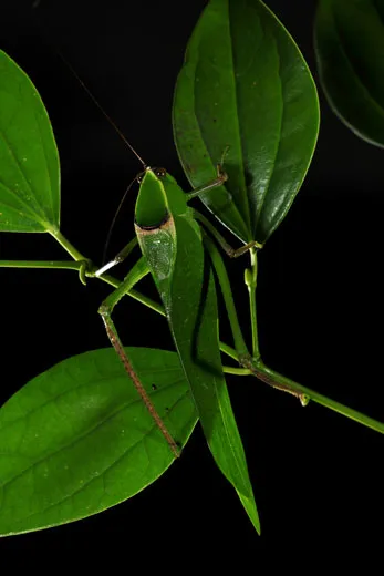
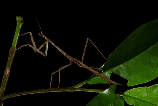
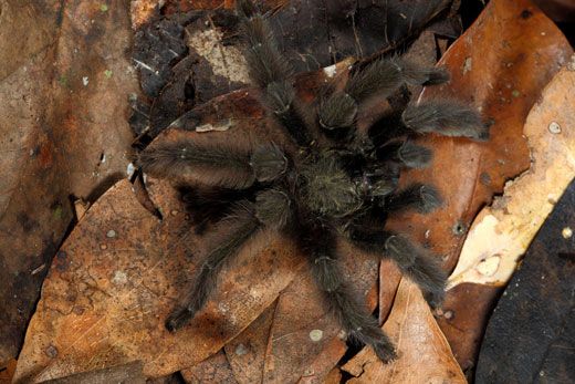
“The basin is a contained, enclosed, integrated cultural and natural system, unique in the world,” Hansen said. And a veritable ark of biodiversity with some 300 species of trees (many festooned with orchids) and upwards of 200 animal species (many endangered or threatened), from tapirs and crocodiles to five of the six cats indigenous to Guatemala. In the past few years, researchers have found two bird species—the hooded oriole and the Caribbean dove—for the first time in Guatemala, and discovered nine previously unknown moth species. Efforts to preserve the basin’s ancient ruins go hand in hand with conserving one of the world’s living treasures.
When Hansen came to the Mirador basin as a graduate student in 1979, scientists had been studying the better-known Maya sites in Mesoamerica—such as Palenque and Copán—for more than a century. El Mirador (“the look-out” in Spanish) was still largely unexplored. While some of the basin itself had been surveyed in 1885 by Claudio Urrutia, an engineer who noted the presence of ruinas grandes, the existence of El Mirador wasn’t officially reported until 1926. And it would be another 36 years before an archaeologist, Harvard University’s Ian Graham, would map and explore a portion of the area, partially revealing the extraordinary dimensions of the city.
What was most puzzling was the age of the site. Monumental architecture on the order of what had been found at El Mirador had always been associated with the Classic period of Maya history, from A.D. 250 to about A.D. 900; architecture of the Preclassic era, from 2000 B.C. to A.D. 150, was supposedly less sophisticated (as were, presumably, its political and economic systems). For nearly 40 years the only known Preclassic structure was a nearly nine-yard-high truncated pyramid excavated in the 1920s at Uaxactun, some 12 miles north of Tikal, by a Carnegie expedition. When the late William Coe of the University of Pennsylvania began excavating at Tikal in 1956, he was puzzled by the complexity of the earlier layers. In a 1963 article for the journal Expedition, he noted “things were not getting simpler” or more “formative.”
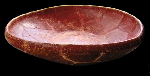
Writing up his own research in 1967, Graham, who went on to found the Corpus of Maya Hieroglyphic Inscriptions at the Peabody Museum of Archaeology and Ethnology at Harvard, speculated that the poor condition of the ruins he examined at El Mirador might be attributed to an inferior brand of mortar rather than the sheer antiquity of the buildings. Examining pottery that Graham’s colleague Joyce Marcus had collected at El Mirador in 1970, Donald Forsyth (now a professor at Brigham Young University) noted that the bulk of the ceramics were in the Chicanel style—monochrome red, black or cream, with thick bodies and the rims turned outward—that clearly dated the surrounding ruins to the Late Preclassic period (300 B.C. to A.D. 150). But could such monumental public architecture really have been built 700 to 1,000 years before the zenith of the Classic period, when, scholars supposed, the Maya had achieved the organizational, artistic and technical expertise to pull off such feats?
The dig Hansen joined was headed by his thesis adviser, Ray Matheny, from Brigham Young University, and Bruce Dahlin of Catholic University. “[Hansen] was a real go-getter,” Matheny told me later. “I’m very proud of him.” Twenty-six years old at the time, Hansen had grown up in Idaho in a Mormon family, the oldest of three brothers. He got a bug for archaeology at age 6 hunting arrowheads on his father’s potato farm in Rupert. He planned to become a lawyer, but his undergraduate degree was delayed after he shattered his right leg in a ski accident. As all he needed for law school were good grades and test scores, he thought the fastest way to get them would be to major in Spanish, which he spoke, and archaeology, which he loved. Degrees in hand, he postponed law school for the chance to join an excavation north of Tel Aviv for two years, an experience that buried the lawyer and begot the archaeologist. It also turned up his wife, Jody, a scientific illustrator who first impressed him with her dogged work hauling buckets of sand. When they returned from Israel, Matheny invited Hansen to assist with a newly funded project at El Mirador.
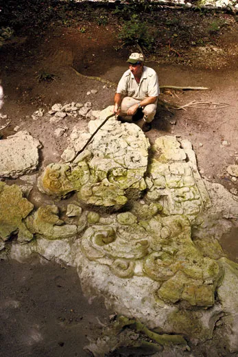
So it was that Hansen found himself in March 1979 excavating a room on Structure 34, the Jaguar Paw Temple. The temple, one of the most intensively studied of all the ruins at El Mirador, is part of the Tigre complex in the western side of the city. Hansen had been given to understand it was most likely from the Classic period, but as he cleared the chamber, he came to the original plaster floor littered with pot fragments that had not been disturbed for centuries. “When the Maya walked away, they left everything in place,” he said. “We’ve found flakes of a stone tool right around the tool.” The potsherds had the colors and the waxy telltale feel of the Chicanel style, which dated the temple to two centuries before Christ. Hansen stared at them in disbelief.
“I realized at that moment the whole evolutionary model for the economic, cultural and social history of the Maya was wrong. The idea that the Maya slowly became more sophisticated was wrong. And I thought, ‘Man, I’m the only person in the world at this moment who knows this.’”
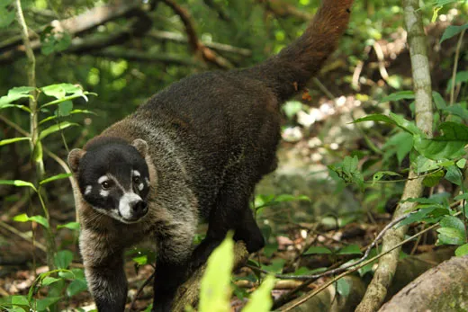
By morning Tropical Storm Richard had eased, but the sky was still overcast and Hansen was surprised to hear the helicopter arriving out of the clouds. “You made it! Welcome!” he cried as three Californians scurried clear of the rotor: Andre Lafleur, an officer for a land trust in Santa Cruz; a travel consultant named Randy Durband; and Joanna Miller, a board member of the Walt Disney Family Museum, established in San Francisco to commemorate her famous grandfather. They joined us at the dining hall for a breakfast of eggs, tortillas, beans and fried Spam. Dominga, the cook, tossed a few stale tortillas into the woods and called “Pancho! Pancho!” Duly summoned, a white-nosed coati appeared, wary and cute, striped tail high. He looked like a lanky raccoon.
Andre, Joanna and Randy had been invited by the Global Heritage Fund, a Palo Alto-based conservation group—and one of several foundations that financially support Hansen’s work in the basin, including the Foundation for Cultural and Natural Maya Heritage (PACUNAM) and Hansen’s own Foundation for Anthropological Research and Environmental Studies (FARES). The FARES board includes actor Mel Gibson, who has given several million dollars to the cause and who hired Hansen as a consultant for his 2006 Maya chase film Apocalypto.
We headed east on a dirt track in two Kawasaki all-terrain vehicles. At more than 14 square miles, greater El Mirador is three times the size of downtown Los Angeles; for many years Hansen would routinely hike 10 to 12 miles a day to check on various sites. The ATVs, donated by a family of prominent Central American brewers, were much appreciated by his now 58-year-old knees. We were bound for La Danta, the pyramid complex we had circled on the flight in.
The trail climbed over what was once possibly a 60-foot-high perimeter wall surrounding a portion of the western part of the city—it was built in the Late Preclassic, Hansen said— and followed one of the elevated causeways to La Danta just over a mile east. We parked and started our ascent.
Hansen has excavated, mapped and explored 51 ancient cities in the Mirador basin. “What you had here was the first state-level society in the Western Hemisphere, a thousand years before anyone suspected,” he said. It was not just the monumental architecture of La Danta and structures at sister cities like Nakbe and Tintal that were sophisticated. The achievements of the Preclassic Maya were reflected in the way they made the leap from clans and chiefdoms to complex societies with class hierarchies and a cohesive ideology; in the technical sophistication that enabled them to quarry huge limestone blocks without metal tools and move them to building sites without the wheel; how they collected rainwater off building roofs and stored it in reservoirs and cisterns; how they projected time in their calendars and preserved the records of their civilization in their still-enigmatic histories on stelae in images and glyphs that scholars have yet to decipher (unlike glyphs from the Classic period that have been decoded); how they constructed their homes with posts, stone and stucco; decorated their teeth with jade and brownish-red hematite inlays; imported exotic items such as obsidian, basalt and granite; wrapped the craniums of their infants to modify the shape of their skulls; and adorned themselves with shells from the Caribbean and Pacific Coast—as if civilization were keyed as much to aesthetic refinement as to written language, the specialization of labor or regimens of religious and social control.
To feed their burgeoning population, they terraced fields and carried mud up from swampy marshes to grow maize, beans, squash, cocoa, gourds and other crops. “What brought them here were the swamps,” Hansen said. And in his view it was the destruction of the swamps with their nutrient-rich mud that caused the wholesale collapse of the society sometime between A.D. 100 and 200. What killed the swamps and crippled the farms, he believes, was the runoff of clay into the marshes after the massive deforestation of the surrounding area—deforestation caused by a demand for firewood the Maya needed to make lime plaster. They plastered everything, from major temples like La Danta to their plazas and house floors, which over time got thicker and thicker, an extravagance Hansen attributed to the temptations of “conspicuous consumption.”
Hansen believes that El Mirador’s inhabitants may have initially gone to the Caribbean coast and then migrated back inland, where they finally ended up in Mexico’s Yucatán Peninsula at Calakmul, which emerged as a powerful city-state and rival to Tikal in the sixth and seventh centuries. “Mirador was known in the Preclassic as the Kan Kingdom—Kan meaning ‘snake’—and the kings of Calakmul referred to themselves as the Lords of Kan, not as the Lords of Chiik Naab, which is the original name of Calakmul,” Hansen said.
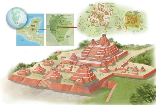
We came to the first tier of La Danta pyramid, a high forested platform of cut stone and rock fill that was some 980 feet wide and 2,000 feet long and covered nearly 45 acres.
“We calculate that as many as 15 million man-days of labor were expended on La Danta,” Hansen said. “It took 12 men to carry each block—each one weighs about a thousand pounds....We’ve excavated nine quarries where the stones were cut, some 600 to 700 meters away.”
Before long we mounted another platform. It was about 33 feet high also and covered about four acres. The trail led to a set of steps that climbed to a third, 86-foot-high platform that served as the base for a triad of an impressive central pyramid flanked by two smaller pyramids—a formidable sight with its vertiginous staircase bisecting the west face.
“You don’t find the triadic pattern before about 300 B.C.” Hansen said of the three pyramids. Based upon conversations with present-day Maya spiritual leaders, researchers believe the three-point configuration represents a celestial hearth containing the fire of creation. The Maya thought three stars in the constellation Orion (Alnitak, Saiph and Rigel) were the hearth stones surrounding the fire—a nebula called M42, which is visible just below Orion’s belt.
Archaeology at El Mirador is often less about bringing the past to light than keeping it from collapsing: Hansen spent three years just stabilizing the walls of La Danta. He had experimented to find the optimal mortar mix of finely sifted clay, organic compounds, lime, crushed limestone and a form of gritty, decomposed limestone called “sascab.” And the archaeologists decided against clearing the trees entirely off the temples as had been done at Tikal because they had learned it was better to leave some shade to minimize the debilitating effects of the sun. Hansen and an engineer from Boeing had designed a vented polycarbonate shed roof that filtered ultraviolet light and protected some of the most delicate stucco carvings on the Jaguar Paw Temple from rain.
We hiked around the base of the upper platform and climbed a cantilevered wooden staircase that zigzagged up the near-vertical east face of La Danta, which plunged more than 230 feet to the jungle floor.
“Wow!” said Joanna.
The summit was the size of a decent home office. There was a surveyor’s bench mark embedded in the limestone, a fence to keep you from tumbling off the east precipice and a big leafy tree that from afar stood out like a tasseled toothpick pinned to a club sandwich. After concentrating so long on the ground, verifying that roots weren’t snakes, it was a great pleasure to lift my eyes to infinity. It was boggling to think we were standing on the labor of thousands of people from antiquity, and to imagine their vanished metropolis, the business of the city such as it might have been on a day like this; the spiritual and ideological imperatives that lifted these stones; the rituals that might have occurred at this sacred spot—everything from coronations to ceremonies in which priests and kings would draw blood from their genitals to spill onto paper and burn as a sacrifice to the gods.
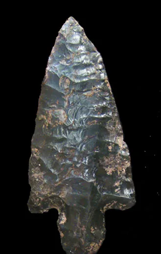
To the west loomed the forested silhouettes of the Tigre Complex, where high on the pyramid Hansen and his team have found skeletons with obsidian arrow points in their ribs, possibly casualties of an Early Classic period battle that wiped out remnant inhabitants of the abandoned capital. Also visible were the outlines of the Monos and Leon pyramids, which along with Tigre and La Danta and the administrative complex known as the Central Acropolis, made up some of the oldest and largest concentrations of public architecture in all of Maya civilization.
I asked Hansen, if he could have anything, what would it be?
“Fifteen minutes,” he answered immediately. “Fifteen minutes here when the city was in its glory. Just to walk around and see what it was like. I’d give anything for that.”
In Maya cosmology the underworld is ruled by the Lords of Xibalba (shee-bal-BA). In April 1983, his fifth season at El Mirador, Hansen nearly met them. He boarded Professor Matheny’s single-engine Helio Courier H395 with his wife, Jody, and their daughter Micalena; he was carrying the only two copies of his master’s thesis, which he’d been working on at the camp, and cash for the camp workers’ payroll.
When the plane cleared the trees it was suddenly running with the wind, not into it as a windsock had indicated, and struggling for lift. About two miles from the airstrip, the tail hit a tree, the nose pitched down, the wings sheared off, the propeller chewed through the canopy until it snapped and the plane cartwheeled across the floor of the jungle. The H395 crashed to a stop in a tree five feet off the ground, fuel leaking everywhere. Hansen sat in his seat thinking he was dead.“Get out! Get out!” Jody yelled. As they scrambled clear, they heard a tremendous whoosh and were hurled to the ground as a fireball exploded behind them, cresting high above the trees. Everyone on board had survived.
“People say, ‘Is your life like Indiana Jones?’” Hansen recalled as he showed us around the crash site. “I say my life isn’t as boring. He always jumps out of the airplane before it crashes.”
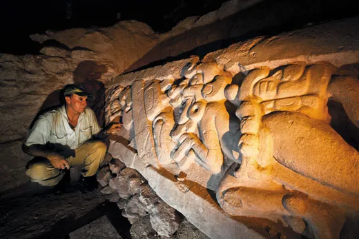
Hansen took us to see what is probably the most beautiful and significant artwork found so far at El Mirador: the Central Acropolis frieze. In 2009, an Idaho State student archaeologist named J. Craig Argyle unearthed two 26-foot carved stucco panels showing the hero twins of Maya cosmology, Hunahpu and his brother Xbalanque. They are the main protagonists in the Popol Vuh, a sacred book of myths, history, traditions and the Maya story of how the world was created. The Popol Vuh recounts the adventures of the supernaturally gifted twins, who resurrected their father Hun-Hunahpu (who had lost his head in a ball game against the evil lords of the underworld). The stucco frieze depicts Hunahpu in a jaguar headdress swimming with the head of his father.
“To find this story in the Preclassic period is beyond belief,” Hansen said, pulling back a blue tarp that covered the frieze. “For many years it was thought that the Popol Vuh creation story had been contaminated by the Spanish priests who translated it—that the Indians had been influenced by Christianity. This frieze shows that the Maya account of creation was vibrantly established for thousands of years before the Spanish got here. It’s like finding the original copy of the Constitution. I was stunned.”
El Mirador today is part of the Mirador-Río Azul National Park, which itself is part of the Maya Biosphere Reserve, an 8,100-square-mile tract of rain forest in northern Guatemala. The reserve, established in 1990, has lost nearly half of its forests in just the past ten years. The protection afforded by the national park, which was set up at the same time, is marginal at best—it covers only a narrow swath of the northern basin along the Mexico border and includes only 3 or 4 of the 51 ancient Maya cities currently mapped. “The boundaries don’t respect the hydrological, geological, geographic, botanical or cultural borders of the basin,” Hansen said. “The park only saves a small area. We’re trying to save the whole system.”
Hansen and conservationists from Guatemala and around the world are hoping the government will declare the whole basin a roadless wilderness. Hansen hopes its ancient cities will attract ecotourism and provide livelihoods for local Guatemalans, who might otherwise turn to looting, poaching or the unsustainable promise of logging; despite short-term economic benefits, the industry undermines the long-term integrity of the ecosystem, as it leads to roads, cattle pastures and the destruction of habitat.
“We’re trying to give the poor campesinos [peasants] more than they have now,” Hansen said. “Every country needs wood and wood products. But the issue here is the potential for far greater economic benefits than can be generated [by logging]. There is a model that will work, and is far more lucrative economically, and has far better conservation results than anything in place now. It will need to be done right. If the area is declared a roadless wilderness, then tourists will be obligated to travel to the local communities rather than fly or drive directly to the sites. They will buy local artisan products, sandwiches, soft drinks and beers, and sleep in local microhotels, and hire local guides, cooks, mules, and rent local mountain bikes. The economic pie would get spread among the communities.”
He supports those uses of the El Mirador forest that are sustainable, such as the harvesting of renewable plant products: allspice; xate, the Chamaedorea palm leaves used in floral arrangements; bayal, for wicker baskets; and chicle, for chewing gum.
And, of course, he supports archaeology, which has already pumped millions of dollars into the local communities of the Petén, as the region is called. Some of the guards Hansen has hired are former looters. Most of the workers hired to help excavate the ancient cities participate in literacy classes run by the Mirador Basin Project, which has also provided local schools with computers and computer training, helped install water-purification filters in villages and trained local residents to be guides. The future of the basin ultimately depends on the local people and communities.
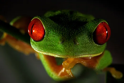
My last evening in El Mirador I stopped in the forest not far from the Jaguar Paw Temple, where Hansen had his potsherd epiphany. It was unsettling to think how thoroughly the Preclassic capital of the Maya and hundreds of thousands of people had been silenced by time and rampant nature. The sun was hurrying away, darkness rising. Ocellated turkeys were ascending to the trees for the night, their wings laboring against the plush air. Red-eyed tree frogs were beginning to sing. Curassow birds fussed in the canopies. You could hear the cool interjections of a spectacled owl; cicadas droning; the croak of toucans; lineated woodpeckers running their jackhammers; the grunts of spider monkeys and the fantastic aspirated roar of howler monkeys, which seemed to cross the basso profundo of an African lion with the sound of metal grinding on a lathe. It always amazes me how unsentimental nature is, resoundingly here now, unbound by the past apart from what is secretly conserved in genes. It’s left to us to listen for voices that can’t be heard, to imagine the dead in that note between the notes, as in those moments when the jungle cacophony dies away and the almost-audible strains of the underworld echo in the stillness and silence of the night, until the clamor of the living starts up again.
Chip Brown is a contributing writer for the New York Times Magazine and the author of two nonfiction books. Photojournalist Christian Ziegler specializes in science and nature subjects.
