Ecologist Roman Dial removes a shell from his 12-gauge shotgun.
“Wherever this lands,” he says, tossing the shell over his shoulder, “will be the center of our first study plot.”
We stand in a sparsely wooded valley, 23 miles as the raven flies from the nearest road. That road is the only thoroughfare in an Arctic wilderness the size of California, and our party of seven left it five days ago, heading east through mountains in packrafts and on foot. For the next 37 days and 320 miles of travel, we will not see another human.
The gun is for the grizzlies, who are fresh out of hibernation and mad with hunger. We have traversed mountainsides pocked with craters, where ravening bears have moved a ton of earth for a bite of ground squirrel. They’re so hungry that Dial has instructed us not to warn them of our presence, but instead to “sneak through.”
Why all this sneaking around? Because something strange is happening in the Far North. This valley marks the northern treeline, the diffuse boundary beyond which the mountains and tundra stretch treeless to the Arctic Ocean. As the planet warms, this treeline may be on the move.
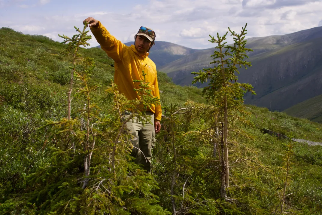
Dial finds the shotgun shell in a tangle of feather moss and lichen. We set down our packs and begin to sweep the surrounding area. From our feet, we notice several shin-high spruce seedlings. We look closer, combing the understory like grooming monkeys. Suddenly a new world comes into focus: A generation of toe-height trees, not more than a few years old, bristles through the soil.
I pluck one and pass it to Dial.
“Yup, that’s a seedling,” he says, his ice-blue eyes ablaze. “This is gold.”
***
In 1799, Prussian naturalist Alexander von Humboldt embarked on a five-year adventure in the Americas that would change the natural sciences forever. As he paddled the Amazon, crossed the Llanos and climbed an Ecuadorian volcano, he collected countless plant specimens and meteorological measurements that he later used to plot lines of equal average temperature—now known as “isotherms”—onto maps of vegetation. The resulting charts illustrated a tremendous discovery: geography and climate govern the distribution of flora across the globe.
Since Humboldt’s time, our planet has warmed dramatically. Mean air temperatures over land have increased on average by 2.7 degrees Fahrenheit since 1880, and polar landscapes have warmed by more than twice that. Accordingly, many plant populations are moving toward the poles for more hospitable climates. These advances are part of what scientists have called the “greening” of the Arctic: an expected increase in plant productivity caused by higher atmospheric temperatures and CO2 concentrations. Such changes are already triggering ecological shifts in some parts of the Arctic and may cause further warming.
But mysteriously, these changes have not occurred everywhere. In the 1990s, researchers were surprised to find that many trees in the eastern Brooks Range didn’t seem to be growing faster than before. In fact, some were growing at slower rates. In 2009, a synthesis study by several researchers in New Zealand showed that of 166 treeline sites monitored around the world, only a little more than half had advanced since 1900, with the rest remaining stagnant. These findings challenged Humboldt’s longstanding belief that temperature alone determines the locations of treelines, with trees ceasing to exist only where temperatures are too cold for cell division to sustain them.
“You would think: ‘It’s another treeline; the trees are temperature limited; as soon as it gets warmer, man, they should grow!’” says ecologist Martin Wilmking, one of the first researchers to notice that many treelines were defying expectations. “Well, they should. But we also have seen that that’s simply not the case.”
A few hypotheses have emerged to explain this phenomenon, but it remains a mystery. That’s why, in 2018, Dial and Paddy Sullivan—a researcher at University of Alaska Anchorage—secured National Science Foundation (NSF) grants to study treelines across the 600-mile length of the Brooks Range, from the Bering Sea to the Canadian border.
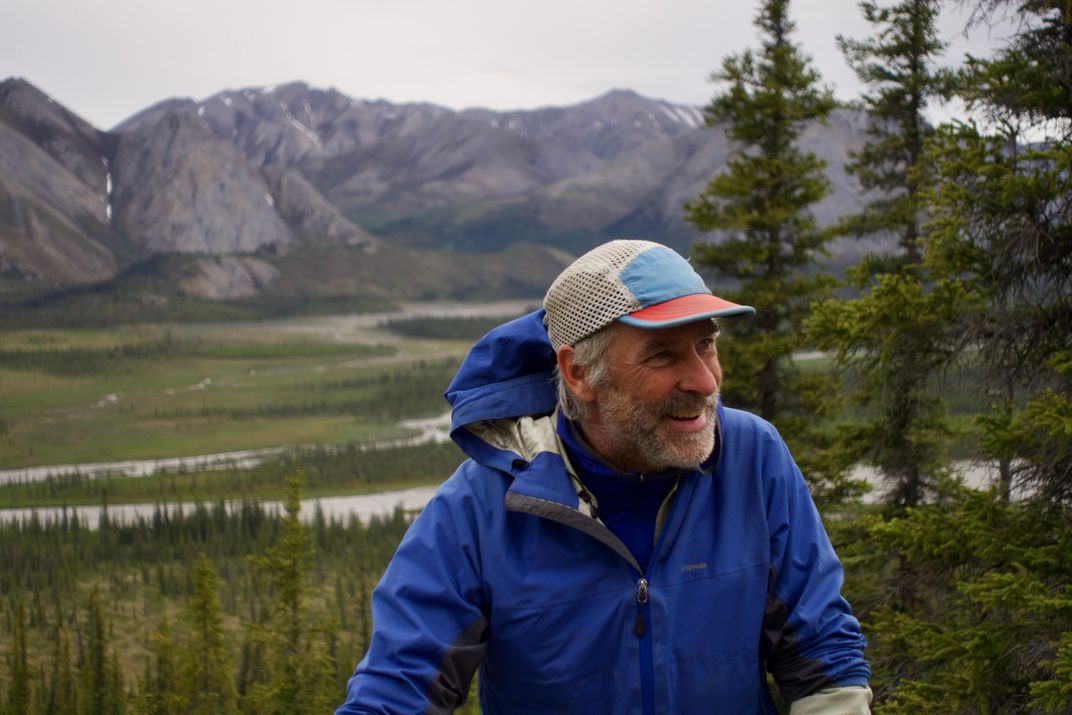
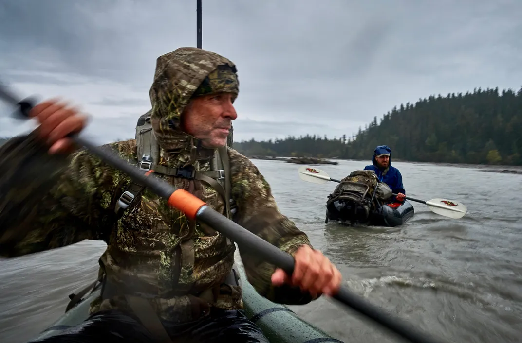
Collecting this data would present significant logistical challenges, especially in the east. There are scarcely any well-maintained airstrips in the region, and the weather is often too unruly for small aircraft. Rather than travel by bush plane, Dial decided that he and his team would walk through the mountains and paddle the rivers in packrafts—inflatable boats that pack down to the size of a paper towel roll. A bush pilot would deposit barrels filled with food and scientific equipment along the route to sustain them.
When asked about Dial’s plan, Matt Irinaga—who organizes logistical support for dozens of NSF projects in Arctic Alaska every year—just laughed. “As far as his mode of transportation, he’s the only one.”
Dial was uniquely qualified. A National Geographic Explorer, he had ventured to Alaskan ice fields to study snow algae, to Himalayan glaciers in search of ice worms and to the tops of 200-foot-tall koompassia excelsa trees in Borneo to study canopies. He literally wrote the book on packrafting and was the four-time winner of the Alaska Mountain Wilderness Classic, a competition in which participants race more than a hundred miles across some of the harshest terrain in Alaska.
Over years of exploration, Dial had come to agree with Humboldt that immersive interaction offers distinct scientific advantages.
“Walking across the landscape, I’m able to develop my intuition about what’s going on,” he says.
Aside from developing a keener sense for the mechanisms of treeline advance, the team accompanying Dial—a PhD student, a young data technician and four undergraduates including me—would also observe a wide range of other new phenomena in a rapidly changing region so remote that few ever visit. We would document rapid permafrost thaw, out-of-place wildlife and shifting vegetation distributions, all in hopes of later solving the mystery of how treelines advance.
***
“I like talking about the biology of tussocks because it makes it easier to get through ‘em,” says Dial, breathing heavily.
Forty miles from our first field site, we are now slogging through tussocks—unstable clumps of sedge grass that dominate the Arctic tundra. The forester and conservationist Bob Marshall, who studied Brooks Range treelines in the 1930s, described trudging through tussocks at their worst. “At least a hundred times in each of three endless miles we would find ourselves sitting on the ground . . . with an overhanging cliff of sedge formation nearly waist-high towering above us,” he wrote. “We would grit our teeth, gather energy, and pull ourselves up the necessary three feet—only to do it all over again within the next twenty paces.”
Yet the tussocks before us are not nearly so formidable as they can be. These are drying, and among them have begun to grow clumps of heather, blueberry and willow shrubs. The previous summer, as Dial and I drove to the start of a moose hunting trip, he repeatedly pointed to mountainsides that had once been tundra but were now covered in shrubs. “This area has gotten so much shrubbier,” he said several times. “The whole state has gotten shrubbier.”
Dial’s comparisons are not just visual, but experiential and systematic. In his youth, during the long miles of bushwhacking that inevitably attend Alaskan wilderness travel, he developed a five-tier brush classification system. ”Class four: you need your body weight. ‘Football brush,’ I call it. You can break an arm in class four. . . .” Dial has since studied brush with more quantitative rigor, using repeat aerial imagery to discern the territorial expansion of shrubs in Southcentral Alaska. Similar studies have been done in much of the Arctic, with similar results: Shrubs, like trees, are rapidly moving into many new areas as climate warms.
While trees and shrubs generally counteract global warming by drawing carbon out of the atmosphere and converting it to biomass, plants don’t grow very large in the far north. It’s too cold. Meanwhile, the canopies of trees and shrubs are darker in color than the tundra they replace, and far darker than snow, which blankets the low-lying tundra for roughly two-thirds of the year. Darker surfaces absorb more sunlight, heating the earth more. “That’s a pretty dramatic change to the planet’s surface-energy balance if it happens over a large area,” says geographer Mike Loranty of Colgate University. Most research suggests that this warming effect will more than offset the cooling effect new trees and shrubs have by fixing carbon.
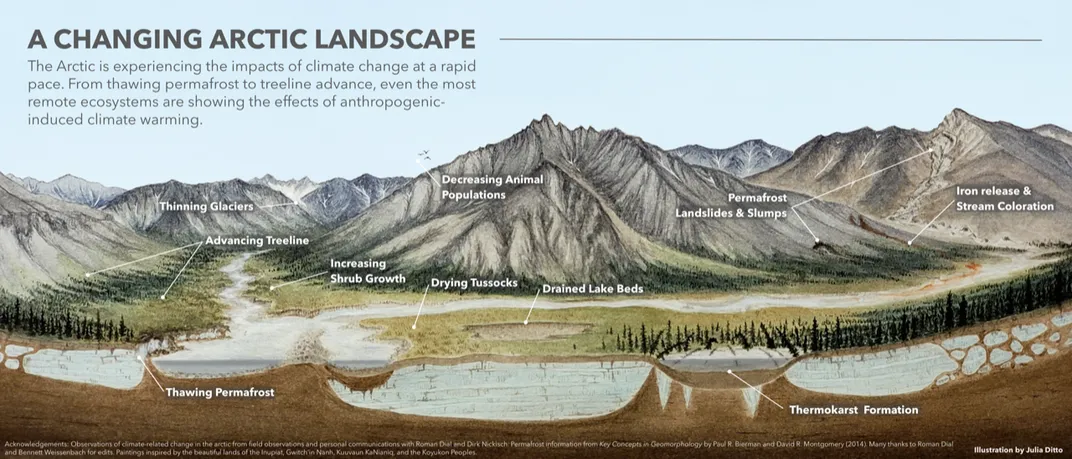
Dial believes that it is not warming, but rather drought, that has reduced the tussocks before us to their more ankle-friendly form. “Most of these shrubs are moving in between the tussocks,” he observes, “which makes me think this change is because of drying.” The wells between the plants, typically waterlogged, have dried out. Shrubs, which require less water than tussocks, seem to be moving into this new habitat before climbing into the tussocks themselves.
While warming temperatures have boosted plant productivity in some parts of the Arctic, they have caused drought in others. Most of the Arctic receives less precipitation than Los Angeles, and perennially frozen soil, called permafrost, has historically trapped water at the surface. Yet warmer temperatures deepen “the active layer”—the top section of permafrost that thaws every summer and refreezes in the winter—allowing water to seep deeper into the earth, and out of reach to vegetation. And while a warmer climate brings more precipitation to some parts of the Arctic, it also evaporates more water from soils and plants.
Drought could explain the different rates of growth observed across the Brooks Range. The eastern side, separated by mountains and land from all large bodies of water, is far drier than the western side, which receives moisture from the Bering Sea.
“There’s a mixed signal,” says Wilmking. “You have a temperature sensitivity and a drought sensitivity, and they interact.”
***
“It’s not fun to walk away from a bear, is it?” says Dial.
Thirty minutes ago, a grizzly bear spotted us and began to stalk us from a distance. Dial led us through forest and over hills to try to lose it. We can no longer see the bear but are not much comforted by that fact.
“I want to sleep on the other side of the river,” says Dial.
No one protests to putting a body of water between us—with our bacon bits and cheeses—and a predator with more olfactory receptors than a bloodhound. But as we descend into the broad valley before us, the landscape does not match our map. We expect to find a lake here; instead, we find an open basin with a thin creek gurgling through it.
The most plausible explanation for the lake’s disappearance is that the permafrost beneath it thawed sometime after 1983, when the USGS last updated its map. The lake would have drained into the earth below—yet another way that a warming climate might be drying this region.
Aside from contributing to drought, thawing permafrost may cause divergent rates of treeline advance through an entirely different mechanism. One reason trees grow faster in warmer climes is that nutrient-producing microbes become more active in warmer soils. But in regions with widespread permafrost, the process of thawing the ground absorbs a tremendous amount of heat each summer—heat that would otherwise stimulate microbial activity.
For this reason, the frigid winters in the eastern Brooks Range—which lead to more extensive permafrost than in the west—might be causing nutrient production to lag behind in the summer. Indeed, based on smaller-scale studies, Sullivan—Dial’s grantee partner—believes that a lack of nutrients, rather than water, may be limiting treeline advance in the east.
We reach the creek and briefly consider camping in the middle of the dried lakebed. “I like that we could see the bear coming,” Dial says. But seeing the bear might not do us much good. We clamber over the far bank and into a thin spruce forest.
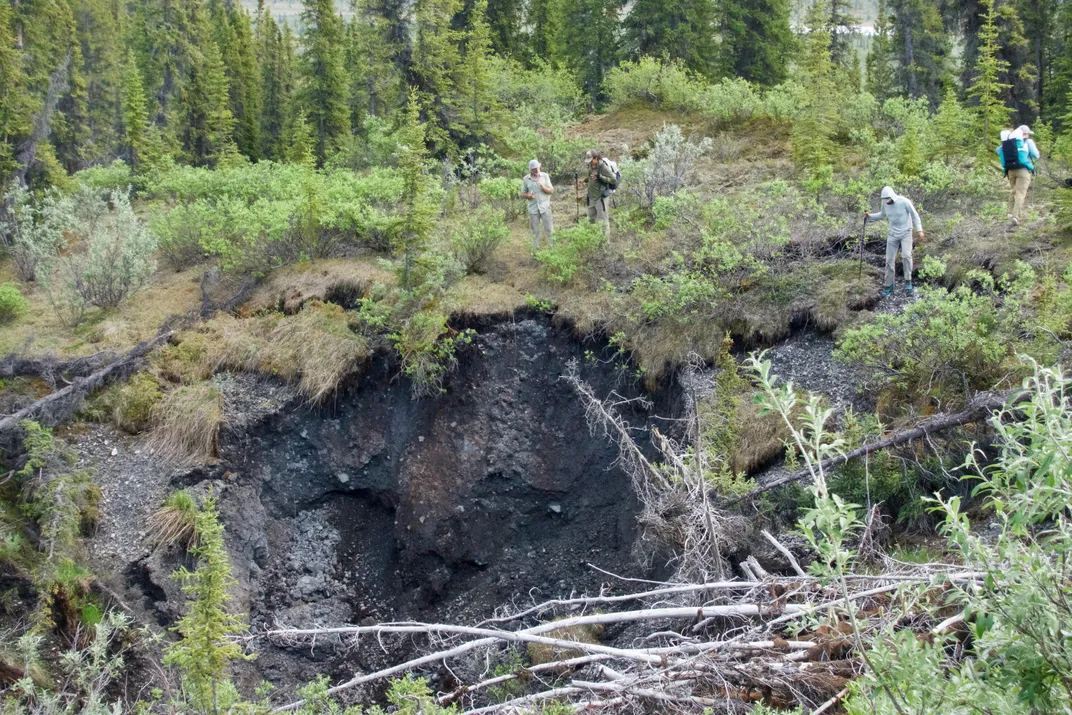
After a few minutes in this direction, we come to yet another feature that is not on our map. About a third of an acre of ground has apparently collapsed into itself, resulting in a pit of murky water and fallen trees roughly eight feet deep. Bone-dry spruce trunks hang over its jagged perimeter.
“Thawing permafrost created that other thing,” says Dial, gesturing towards the dried lakebed, “and thawing permafrost created this.”
Permafrost holds the Arctic landscape together, and when it thaws, the ground can slump or collapse. The bizarre geological features that result, and the processes that shape them, are referred to as “thermokarst.”
Since the 1970s, permafrost across the high Arctic has warmed by three to six degrees Fahrenheit. The temperature of warmer permafrost in the low Arctic and subarctic has increased by less, in part because much of it is in the process of thawing. As this happens, the same microbial activity that supplies nutrients to trees liberates ancient stores of carbon, held in the form of frozen plants and animal carcasses that have accumulated, layer by layer, for millennia.
Permafrost holds a tremendous amount of carbon—more, in fact, than all of the world’s trees put together. How much carbon is stored in vulnerable permafrost, how quickly this permafrost will thaw and how much of this carbon will be released as methane—a greenhouse gas about 30 times more potent, over a century timescale, than CO2—are some of the biggest questions facing scientists and climate modelers today.
Shrub and treeline advance matters in part for how it might affect permafrost. While trees and shrubs shade the ground in the summer, they also trap wind-blown snow in the winter, insulating underlying permafrost from the coldest temperatures of winter. But the implications of treeline advance for our climate—both its potential to thaw permafrost and to decrease the reflectivity of the Earth’s surface—pale in comparison to the potential impact of thermokarst features like the one we now stand before.
In contrast to the gradual process of top-down thaw, thermokarst suddenly exposes permafrost to the elements, which quicken the rate of thaw and decomposition. The ice-rich areas most vulnerable to thermokarst also tend to hold the most carbon. The water that often pools in thermokarst features, left over from the melting of ground ice, can cause much of this carbon to be released as methane. And scientists believe that higher temperatures and more devastating fires are causing thermokarst to occur more frequently in the Arctic.
Climate models currently project that carbon released from thawing permafrost will cause approximately one-quarter to one-half a degree of additional warming by the end of the century, and one-half to a full degree by 2300. But of all the feedbacks to climate change, this is one of the least-well understood, and recent research into thermokarst suggests that these estimates are low.
“[Rapid permafrost thaw] could amplify the permafrost carbon feedback by up to a factor of two,” says David Lawrence, who coordinates land modeling for the National Center for Atmospheric Research. “And it’s something our models are currently not accounting for.”
***
Dial has been exploring the Alaskan wilderness since 1970, when he was nine years old. That summer, his parents shipped him from the suburbs of D.C. to spend several months with his uncles in rural Alaska. He took a correspondence course in taxidermy, acquired a .22 caliber rifle and spent his days roaming the mountains with a wolfdog named Moose.
He went on to become a renowned mountaineer, scaling unclimbed peaks and frozen waterfalls across Alaska. He finally quit alpinism after one particularly close brush with death in 1986 when, on the way down from a first ascent of a route called “Cutthroat Couloir,” his climbing partner broke through a cornice and began to free fall. In a moment of quick thinking, Dial launched himself off the opposite side of the ridge, falling 200 feet sheer but saving them both in the process. Afterward, he swore off climbing, proposed to his now-wife, Peggy, and had two kids.
But Dial continued adventuring, and after a lifetime of 30, 50 and 80-mile days, his hips were shot. As we travelled, he sang a rendition of the 1983 hit by Huey Lewis and the News, “I Want a New Drug”: “I want a new hip / One that won’t make me limp.” At night, I would hear him sighing in pain as he tried to sleep.
One night, as we lay in our sleeping bags under a rare stand of old-growth spruce, he admitted that the thrill of adventure had obsessed him for much of his life. He was now learning to appreciate the birds, the bears, the caribou trails. His own health, too, and the health of the planet itself. He had brought us youngsters along, he said, because we were excited simply to learn from this place.
And as the trip wore on, it became clear that he had brought us less for what we could offer him, and more for what he hoped to offer the future.
One evening, Dial read to us from a memoir he had written and was preparing to publish. The book—now a national bestseller called The Adventurer’s Son—was about his son, Cody Dial, who had inherited his love of science and adventure, and who had disappeared in 2014, at the age of 27, while exploring a rainforest in Costa Rica.
The book described Cody’s childhood, and the relationship the two had built through their shared passion for the natural world. The bottomless despair he had felt when his son had disappeared, and the nearly two years of uncertainty as he searched the Costa Rican wilderness for his body. The mixture of anguish and relief when he discovered the truth.
As he neared the end of the book, Dial started making strange noises. It didn’t sound like crying, exactly, but more like he couldn’t get enough air into his lungs—as though a piece of him were literally missing.
“I hope you guys never have to write a book like that,” he said.
***
As we travelled farther east, the landscape became drier. We passed lakes that had drained or evaporated so recently that shrubs had only just begun to move in. The water-loving alder shrubs, relatively common farther west, petered out. “This looks like it could be a savannah of Africa,” said Dial one day, surveying a dull, tan expanse.
We also found fewer white spruce seedlings. This might suggest that treelines are about to advance rapidly where we began our research, and hardly, if at all, farther east. Yet trees tend to reproduce at irregular intervals, and populations in the East and West could be on different cycles. We also don’t know how many of these seedlings will survive to maturity. Dial won’t be prepared to draw conclusions until he knows the historical rates of treeline advance, which are still being calculated by comparing past and present aerial imagery.
“At this point, all we can do is speculate,” he said.
The same is true for the question of why many trees here are not growing faster in response to warming temperatures. Whether it’s due to nutrient deficiency, drought or some combination, Dial and Sullivan won’t posit an answer until all of the data are collected and analyzed. This process could take years.
Meanwhile, we continued to travel east—and as we did so, we shed layers. We had packed for Arctic weather but were awakened most mornings by heat. Across Alaska, July 2019 would go on to become the warmest month on record by nearly a full degree, and 5.5 degrees warmer than the 20th-century average. Salmon would die from high water temperatures. Thousands of seabirds would wash up dead on shores. Roughly 1.8 million acres would burn.
When Dial first visited Alaska in 1970, the likelihood of a July this warm occurring even once in a century would have been less than one in ten. But annual average temperatures have been rising steadily since then, and the five warmest years in state history have all come in the past seven years. In fact, of the four seasons in the Arctic, summer is changing the least. Winters have warmed in northern Alaska by roughly 8 degrees over the past 50 years.
“Climate change is not just in the future for Alaska—It’s affecting people’s lives and livelihoods right now,” says veteran climatologist Rick Thoman, who began his career with the weather service in 1987. “Not every summer is going to be this warm, but it’s a harbinger of things to come.”
***
We had begun our journey when the mountains were still purple from the stems of bare dwarf birch and the first willow buds had only just begun to sprout. We watched the stark landscape turn green, then ignite with the vivid purples and yellows and blues of Dryas, lupine, heather, rhododendron, Labrador tea, anemone. “The growing season is so compact in the Arctic that one day here is like a week in the lower latitudes,” explained Dial.
He pointed out forested moraines of glaciers past, and marine fossils imprinted on the rocks, formed millions of years ago in the sea. He observed louseworts, saxifrages and forget-me-nots; bug-trapping butterworts and parabolic, heliotropic Dryas flowers. He gave animated voice to the bears, moose, wolves.
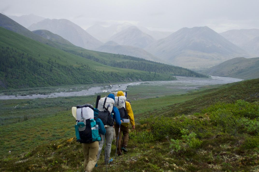
At times, Dial seemed troubled. “Where are all the birds?” he wondered aloud. Over his decades of travel in the Brooks Range, he had watched the skies empty and grow quieter. Over roughly the same period, the world’s bird population had declined by 29 percent.
Yet we also encountered things, as we traveled east, that overwhelmed any sense of loss: A pack of wolves howling balefully between the dinosaur-spine ridges of the Sheenjek Valley. Quarter-sized hailstones battering the mountains and drawing blood from our exposed knuckles. A distraught ptarmigan hen clucking, feigning a broken wing and zigzagging madly over hummocks and horsetail in a desperate attempt to lure us away from the vibrant center of her universe—a brood of downy chicks, blinking and quivering beneath a willow shrub.
A month into the trip, Dial’s hip locked up. He could no longer manage the pain with ibuprofen and hydrocodone, so he arranged for a pilot to pick him up. But Dial was not yet off the hook. The pilot told him that two packrafters had become stranded 40 miles away, and Dial rafted Class III rapids—alone and without a helmet—to reach the pair and shepherd them to safety. The rest of us set out on our own to complete the trip’s final objective: to find and document the northernmost tree in Alaska.
We travelled light and fast, cooking over open fires and all squeezing into one tent. We spent an afternoon and a morning roving a valley on compass bearings to compare several candidates, and on July 8, we converged on the tree.
It wasn’t much to look at—just a short, self-cloning spruce on a nondescript hillside. But it raised big questions: Where will the next generation find the northernmost tree in Alaska when our own hips begin to fail us? What kind of a world will we leave to them?
Three days later, a pilot picked us up near the Canadian border and delivered us to a small village on the southern flank of the Range. From there, we caught an eight-passenger plane back to Fairbanks. “You’re welcome to get in,” said the second pilot before we boarded, “but I recommend you all stay here.” Farther south, fires were ravaging the state.
Soon after the plane took off, a towering wall of smoke appeared on the horizon. Plumes billowed up from the smoldering landscape below. The windows paled, then turned white, and soon we could see nothing but each other and the inside of the plane as it hurtled through the sky.
/https://tf-cmsv2-smithsonianmag-media.s3.amazonaws.com/filer/a6/91/a691d838-9db4-4c53-9dc5-87ce0c4f2395/longform-alaska-treeline-mobile.jpg)
/https://tf-cmsv2-smithsonianmag-media.s3.amazonaws.com/filer/57/ed/57ed0b2b-d432-463d-9b6b-dbfd72dbe480/longform-alaska-treeline-social.jpg)