Scientists Discover Sudden Melting in the Antarctic
Warmer waters are eating away at protective ice shelves, letting glaciers flow into the sea
/https://tf-cmsv2-smithsonianmag-media.s3.amazonaws.com/filer/77/87/7787aa33-520a-4587-8e98-6ccee7e0fff3/wouters3hr.jpg)
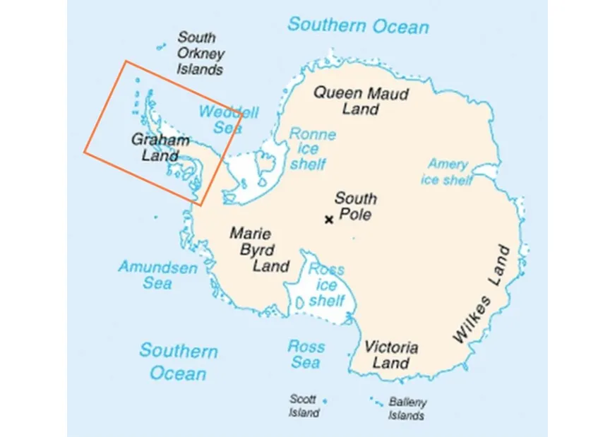
Several glaciers on the southern Antarctic Peninsula suddenly began shedding ice in 2009, satellite observations now reveal. The region has dumped the equivalent of 72 cubic miles of water—enough to fill 350,000 Empire State Buildings—into the ocean since then, researchers report today in Science.
“The region changed from being quiet, in balance, to massive ice loss within a couple of years,” notes lead author Bert Wouters of the University of Bristol. “This is quite surprising, a complete shift of the dynamics in the area. It shows that the ice sheet can react very rapidly to changes in its environment.

That environmental change is a slight warming in the Bellingshausen Sea, which licks a several-hundred-mile stretch along the peninsula’s western coast. Ice shelves line the coast and usually keep the glaciers and ice sheets that sit atop Antarctica in place. But the waters in the Bellingshausen and nearby Amundsen seas have warmed by about 1 degree Fahrenheit in the past 30 years because of changing winds. A layer of ocean called the Circumpolar Deep Water, typically kept far offshore by those winds, has infiltrated coastal areas, warming them up and eating away at the protective shelves.
There is enough ice on Antarctica that, if it all melted, sea level would increase by some 200 feet. No one believes that is likely to happen, but parts of Antarctica are already beginning to melt, and each new observation adds to growing concerns over the fate of the continent and of coastal cities worldwide. Last year, researchers reported that glaciers along the Amundsen Sea in West Antarctica have tripled the rate at which they are melting over the last decade. The newly discovered area of ice loss is second only to the Amundsen Sea sector in terms of water released yearly, contributing about 0.006 inches of sea level rise annually to the world’s coasts, Wouters and his colleagues calculate.
Wouters and his team discovered the ice loss in the southern Antarctic Peninsula when they were looking at data from CyroSat-2, a European Space Agency satellite launched in 2010 that measures changes in the height of Antarctic ice. After comparing those measurements to ones made by earlier satellite missions, the team noticed large changes. “We decided to take a closer look,” Wouters says.
They then gathered data from NASA’s GRACE satellites, which detect changes in Earth’s gravitational pull (changes caused in part by melting glaciers), and found that the region’s ice was stable throughout most of the early 2000s but began losing mass in 2009. That has continued unabated. Climate modeling showed that ocean warming—and not warmer air temperatures or a lack of snowfall—explains the ice loss.
Additional ice loss is probably occurring in the northern end of the Antarctica Peninsula following the break-up of the Larsen A and B ice shelves, in 1995 and 2002, respectively, Wouters says. Over in East Antarctica, the Totten glacier is also losing ice and could become a major contributor to sea level rise. But the southern Antarctic Peninsula glaciers may be particularly vulnerable. The bedrock on which they sit is below sea level. As the region’s ice shelves continue to thin (they have lost one-fifth of their mass in the last 20 years), warm water pushes inland from below, causing the glaciers to melt from underneath, thus speeding their demise.
“The great thing about this satellite era is that we can keep an eye on these regions and witness changes as they happen,” Wouters says. Scientists now have an abundance of data from satellites and other missions, such as IceBridge, which monitors changes in ice from aircraft. Researchers affiliated with that mission last week published data showing that the remnants of the Larsen B ice shelf will be completely gone by 2020.
/https://tf-cmsv2-smithsonianmag-media.s3.amazonaws.com/accounts/headshot/Sarah-Zielinski-240.jpg)
/https://tf-cmsv2-smithsonianmag-media.s3.amazonaws.com/accounts/headshot/Sarah-Zielinski-240.jpg)