Wyoming Paleontology Dispatch #8: Polecat Bench Badlands
Can the team drill past an ancient river channel?
/https://tf-cmsv2-smithsonianmag-media.s3.amazonaws.com/filer/Wyoming-Dispatch-coring-rig-Polecat-Bench-631.jpg)
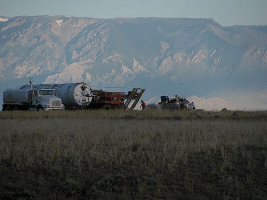
We have completed the coring at Basin Substation ahead of schedule, which means the Basin crew will now move to Polecat Bench to start the coring operation there. Polecat Bench, northwest of Powell, Wyoming, is a long, flat-topped butte with a world-famous (at least among paleontologists!) sequence of Paleocene and Eocene rocks exposed along its steep, gullied sides. The drill site is on a peninsula of the bench, surrounded on three sides by steep badland hillsides that my colleague Phil Gingerich has mapped in great detail. This is a place where we know precisely what strata we can expect to encounter as we core. It also has a stunning view of the Beartooth Mountains, looking like a 5,000-foot wall about 20 miles to the west.
The coring rig moves to Polecat Bench on Monday the 18th, giving us a day of “rest” during which we drive to Powell and arrange the Basin cores on racks in Tom Churchill’s shed. My eyes are still stinging with fatigue from the last four days, which leads me to take an unaccompanied break at a coffee shop in Powell to get caffeine and a smoothie. I’m caught red-handed by Guy and Brady as I emerge and get a hard time for having taken a break while the rest of the team was working. We have high expectations for one another!
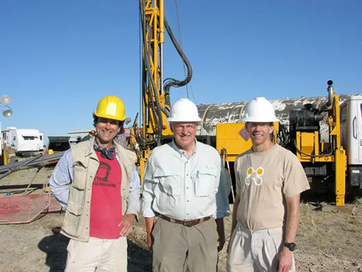
The morning of the 19th we are back to work by 6:45, as Ben and Cody start the first core at Polecat Bench. This time, we all feel like old hands, and we are focused on training the next science crew how to carry out the work. James Super, Daniel and Matthew Gingerich (sons of Phil Gingerich, the chief scientist for the Polecat Bench site), and soon several others will take over our duties as we are released back to our usual projects.
By the next morning the new team members have the hang of the duties, and we are nearly 400 feet down after two very successful shifts of drilling. We have run into a problem, though. Ben reports that he is having trouble making headway because loose sand is falling into the bottom of the hole. Apparently some thick sandstone deposits, representing ancient river channels, were penetrated during the night shift. Hours later these are washing out in massive quantities and falling to the bottom, bogging down the drill bit and making it impossible to proceed any farther. Phil decides late on the afternoon of July 20 that it is time to give up on this hole. But we have a third excellent record of the PETM over 400 feet long.
The night shift will move the coring rig about 30 feet and begin a new hole, this time using special drilling “mud” to help stabilize the loose sand they expect to encounter. In the end they will go down over 900 feet, obtaining a core that not only represents the PETM, but also several hundred thousand years of the last part of the Paleocene. But by then I am far away in the southern Bighorn Basin, back looking for fossil plants in surface outcrops.
Scott Wing is a research scientist and curator in the Smithsonian Institution’s Department of Paleobiology.
/https://tf-cmsv2-smithsonianmag-media.s3.amazonaws.com/accounts/headshot/SLW_photo_-James_Kegley_for_Smithsonian.jpg)


/https://tf-cmsv2-smithsonianmag-media.s3.amazonaws.com/accounts/headshot/SLW_photo_-James_Kegley_for_Smithsonian.jpg)