Aerial Surveys Reveal Possible Fort of Scottish Patriot William Wallace
The freedom fighter may have once used the structure to conspire against English forces
/https://tf-cmsv2-smithsonianmag-media.s3.amazonaws.com/filer/d0/90/d09074af-f541-4d12-ba8f-26886f676e2b/wallaces-house-view-facing-east-copyright-fls-by-skyscape-survey-2020.jpg)
William Wallace is perhaps known best as the kilted, paint-splashed protagonist of the historical fiction (emphasis on “fiction”) film Braveheart. But the true story of how the 13th-century freedom fighter led an intrepid troop of Scots to victory against an English army during the Wars of Scottish Independence is arguably the more compelling tale—and drone-flying archaeologists may have just gotten the best view yet of one of the fabled knight’s “hidden” forts.
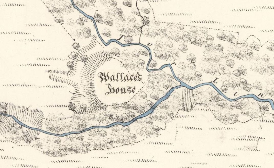
Described in historical documents as a stronghold from which Wallace and his 16 men-at-arms would “sally forth to annoy the English,” the fort—known as Wallace’s House—once lay on a small summit in the wilds of Scotland’s Dumfries and Galloway council area. As Alison Campsie reports for the Scotsman, a team led by Forestry and Land Scotland archaeologist Matt Ritchie recently conducted an aerial survey of the proposed site, cobbling together a three-dimensional model that may offer a glimpse more than 700 years into the past.
“[T]he survey has added a new chapter to an old story,” says Ritchie in a statement.
Wallace’s House is documented in The New Statistical Account of Scotland, a 19th- century publication that painstakingly immortalized the ways of contemporary Scottish life via a series of questionnaires sent to the country’s ministers, according to BBC News. The passage devoted to the fort describes it as the staging ground for Wallace’s plans to capture the Scottish castle of Lochmaben in 1297. A “strong place of defense” boasting timber lodgings atop a regional summit, the fort reportedly offered an “extensive view” to the south.
As Michael Brown, a historian at Scotland’s University of St. Andrews, told Smithsonian magazine’s Meilan Solly in 2018, Wallace is remembered as “the disinterested patriotic hero whose only concern was the liberty and protection of his fellow Scots.”

During the medieval period, England started treating its northern neighbor much like a feudal territory. This arrangement understandably angered Wallace, who famously rallied Scotland’s staunchest patriots. Together, they trounced the English at the Battle of Stirling Bridge in September 1297, but just ten months later, suffered a devastating defeat at the Battle of Falkirk. After the loss, things went south for Wallace, who was ultimately imprisoned and violently executed for his crimes against England.
Wallace’s precise movements in the months surrounding these two pivotal skirmishes remain somewhat mysterious. In an attempt to fill in some of the gaps, a drone dispatched by Ritchie’s team snapped hundreds of photographs of a massive mound of earth situated at the nexus of two deep ravines, one containing the Black Linn River and the other the Tor Linn, according to the Scotsman. The researchers then used software to stitch the images into a model of terrain cloaked beneath tangled vegetation.
“It’s a fascinating and revealing technique that really begins to open up the landscape and this seemed like an ideal site to investigate,” Ritchie tells the Scotsman.
The survey also sets the foundation for future follow-ups.
Centuries after Wallace’s presumed stay, not much evidence remains. But what has been noted so far appears to match historic descriptions of the freedom fighter’s fort. According to the New Statistical Account of Scotland, Wallace and his men eventually took control of Lochmaben—thanks in part to the plans hatched at their forested citadel.
“Could the fort really have been built by William Wallace and his men?” says Ritchie in the statement. “I’d like to think so.”
/https://tf-cmsv2-smithsonianmag-media.s3.amazonaws.com/accounts/headshot/10172852_10152012979290896_320129237_n.jpg)
/https://tf-cmsv2-smithsonianmag-media.s3.amazonaws.com/accounts/headshot/10172852_10152012979290896_320129237_n.jpg)