Discover One of History’s Most Ambitious Maps
Martin Waldseemüller’s 1507 map was the oldest document to use “America” to describe the body of land between Africa and Asia
/https://tf-cmsv2-smithsonianmag-media.s3.amazonaws.com/filer/58/46/58464390-20b4-473f-a014-f61cae92136a/default.jpg)
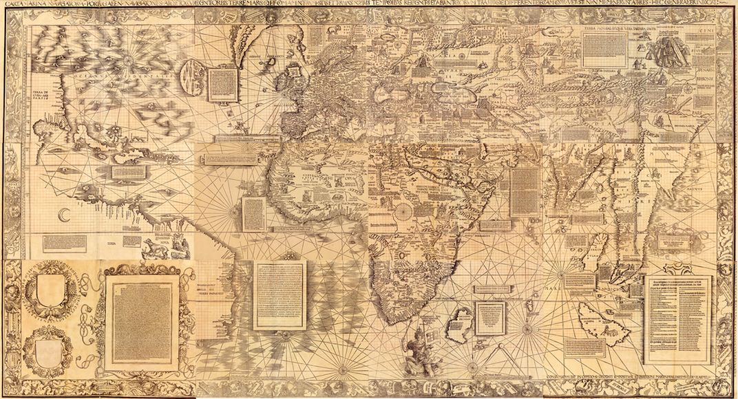
What’s in a map? When viewed as historical documents, most maps go far beyond portraying mere place. Rather, they transmit ideas about the priorities, prejudices and preoccupations of the people who created and used them. And perhaps no map is as important—or as packed with historical promise—as one by German mapmaker Martin Waldseemüller. Now you can delve into the mysteries of the 1507 world map yourself with the launch of A Land Beyond the Stars, a new interactive website that unpacks the map’s many secrets.
It’s the brainchild of the Museo Galileo in Florence, Italy, and was developed with the help of the Library of Congress. The site brings the map to life with interactive features and a cache of historical and cultural context. Relatively little is known about Waldseemüller, the map-making cleric, and his 1507 map, where the term "America" was first coined. (In 2009, Toby Lester argued in Smithsonian magazine that the name might have come not from Waldseemüller but rather from an Alsatian scholar and poet named Matthias Ringmann, who wrote Introduction to Cosmography, the 1507 book the map was first referenced in.)
To create the map, Waldseemüller used the most up-to-date data available at the time, including new discoveries made by explorer Amerigo Vespucci in the New World. The result was the most detailed, ambitious world map that had ever been produced. Only about 1,000 copies of the map—the first ever to depict an Eastern and Western hemisphere split in two by the Pacific Ocean—were initially printed.
Waldseemüller didn't stop there—his lesser-known 1516 Carta Marina, which turns 500 years old this year, was even more boundary-breaking. As historian Chet Van Duzer explains, Waldseemüller apparently threw out his old sources for his new map, adding new information and using new techniques. “The map is a striking testament both to the cartographer's determination to show the true form of the world, and to the dynamism of early 16th century cartography,” Van Duzer notes.

The website devoted to Waldseemüller’s ambitious map was created just in time for the 500th anniversary of the Carta Marina and for “Facts or Fictions: Debating the Mysteries of Early Modern Science and Cartography,” a two-day conference hosted by the Library of Congress in Washington, D.C. The conference also was convened to celebrate the Library of Congress’ acquisition of the Schöner Sammelband, a book that contains the only known copies not just of the Carta Marina, but of other important maps and globe gores, or segments.
The website, in the meantime, explores all of those topics and more. Visitors can uncover the map’s historical context, drill down into geographic regions, check out the map’s climate details, and even browse through a digital library of related books and maps. On its website, the Museo Galileo explains that the interactive website is the result of intensive research on the map. It was designed to share the stories of the map with the broader public and make the map more accessible—a worthy goal for anything that’s so old (and so influential).
So sit back, grab your mouse and take a tour of the globe as it had never before been imagined. Whether you sail the site for its awesome graphics or a sense of the historical context behind the map, one thing is clear: The 1507 masterpiece is much more than a simple case of “you are here.”