Ways to Watch Sandy That Are More Interesting Than Looking Out the Window And Safer Than Going Outside
Ways to Watch Sandy That Are More Interesting Than Looking Out the Window And Safer Than Going Outside

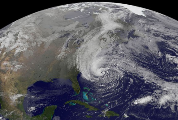
Hurricane Sandy as of 9:02 am EST on October 28. photo: NASA GOES Project
Starting yesterday evening, residents along the eastern U.S. coast and much further inland, from Washington D.C. to Chicago, hunkered down and braced for the arrival of Hurricane Sandy, the biggest hurricane (by area) on record. Ever. (Since 1988.)
If you’re holed up inside or have loved ones who are, you may be looking for better ways to track the storm’s progress. With that in mind:
Where is it?

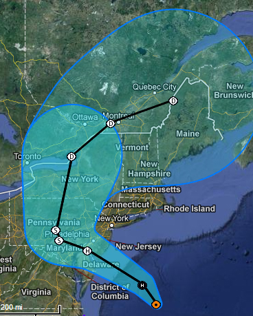
Sandy Map: Photo: NWS National Hurricane Center
As of this morning, the eye of the storm is still sitting offshore, east of Virginia. Over the course of the day, Sandy is expected to move northwest onto Delaware, Maryland and Pennsylvania, before arcing up and around to the northeast. The heavy wind and rain carried by the storm spread much further out than the the eye, however. Check out this real-time wind map to see just how far Sandy can reach: you can see the leading edge of the hurricane pushing into the East Coast. The National Hurricane Center will give you a map of the storm’s projected path, along with some other meteorological projections such as the risk of storm surge.
Google has also put together a map showing the path of the storm. Google’s version has toggles so you can turn cloud cover on and off, show the locations of webcams in the area and chart out the locations of Red Cross shelters.
What’s it look like on the ground?
Mounted to the roof of the New York Times building in central Manhattan, a webcam has been running unimpeded so far, streaming a new photo of the city every minute.
Also, hidden amongst the corny and awful captioned memes, selfies and pictures of people’s food, this rolling search of popular photo-sharing app Instagram provides a window into the on-the-ground the effects of the storm.
What’s it look like from space?
For the most up-to-date view from space, one good bet is NASA MODIS’ real-time view. Though as of the time of this writing the satellite is passing over the Pacific Ocean, it should loop around shortly to get an eye on the storm.
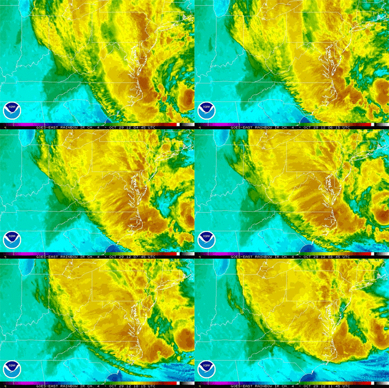
Another good source of satellite imagery are NOAA’s geostationary weather satellites. Look to the East CONUS Visible option to get the view from above.
How can I keep up with the latest?
The twitter accounts of the Atlantic branch of the National Hurricane Center, the National Weather Service and the National Oceanographic and Atmospheric Administration have been pumping out advisories and news about the storm. The National Weather Service also keeps a rolling update of flooding across the US.
NASA Goddard’s twitter and Flickr accounts, as well as NOAA Satellites, have also been updating with the latest imagery.
And, of course, keep track of your local news, which will inevitably have more detail on what’s going on in your area.
More from Smithsonian.com:
Tracking the Twists and Turns of Hurricanes
Tropical Storm Sandy Could Bring Extreme Weather to the East Coast for Halloween
UPDATE: ALL Smithsonian Museums Closed Due to Hurricane Sandy
/https://tf-cmsv2-smithsonianmag-media.s3.amazonaws.com/accounts/headshot/smartnews-colin-schultz-240.jpg)

/https://tf-cmsv2-smithsonianmag-media.s3.amazonaws.com/accounts/headshot/smartnews-colin-schultz-240.jpg)