Scientists Track, For the First Time, One of the Rarest Songbirds on Its Yearlong Migration
The journey of the Kirtland’s warbler is discovered thanks to a combination of the latest tiny technology and centuries-old solar location methods
/https://tf-cmsv2-smithsonianmag-media.s3.amazonaws.com/filer/f7/47/f7479b54-09d5-49ea-b0a5-998bb8c356fb/kw1.jpg)
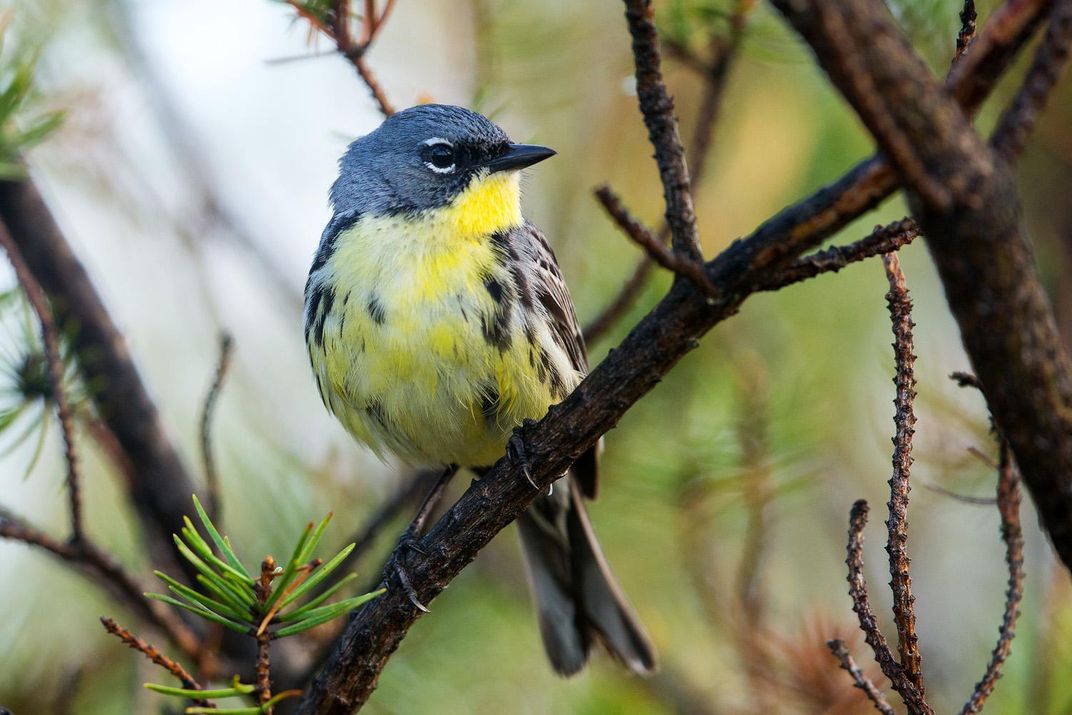
At .48 ounces, your average Kirtland’s warbler weighs about as much as a handful of tortilla chips (seven, stacked), or about the same as one baby carrot. And every year, this rare North American songbird travels nearly 4,000 miles round trip, across mountain ranges, the body of a continent, the Gulf Stream and open ocean. Most of this journey has been a mystery, until now.
Using light-level geolocators, Smithsonian scientists have for the first time tracked and mapped the migratory paths of Kirtland’s warblers for an entire year, following them from their breeding grounds in Michigan to their winter homes in the central Bahamas and back. The scientists hope the data will enable conservation managers to better understand how to manage habitat for the warblers, which were close to extinction in the 1970s and have made a significant comeback as an endangered species.
The research, published in the Journal of Avian Biology, also represents a breakthrough for studying other small species’ migrations, which are an elusive but pivotal element of their lives.
“However difficult it may be, it is critical that we understand the full annual cycle of birds, not just what is happening during breeding,” says Nathan Cooper, lead author of the study and postdoctoral fellow at the Smithsonian’s Migratory Bird Center, part of the Smithsonian Conservation Biology Institute. “There is a significant amount of mortality for songbirds that happens during migration, indicating that the conditions birds encounter while migrating might be major factors in a species’ overall success or failure.”
“We know so little about migration for so many species,” says Pete Marra, head of the Migratory Bird Center and co-author on the paper. “This is the rarest songbird in North America, one of the most endangered. The goal is to move toward tracking the same individuals throughout the year to understand where and why birds are dying, and we’re getting closer with this species.”
Kirtland’s warblers are easy to study in one respect; they only nest in dense, young jack pine forests predominately in specific regions in Michigan. But those forests depend upon frequent fires to propagate the jack pines’ seeds, and fire suppression in the mid-century, coupled with nest predation by the brown-headed cowbird, devastated the species. In 1966 the U.S. Fish and Wildlife Service declared the birds endangered; in 1974, researchers identified only 167 singing males.
By planting new young jack pine forest and implementing a cowbird removal program, conservation managers helped the warblers begin to recover their numbers. Today, their population is estimated at about 2,300 males. It’s a success story, but continued management is crucial.

Although scientists know a great deal about the birds on their breeding grounds in Michigan, they know less about their distribution in the Bahamas during the winter, and migration—which kills an estimated 44 percent of Kirtland’s populations—has remained an unknown.
“Given that they’re flying 2,000 miles in two weeks, it makes a lot of sense that there could be a lot of mortality during that period,” Cooper says. “But we don’t know if it’s driven by things that happen during migration, or if it is set up by events that happen during the wintering period.” For instance, a drought in the Bahamas can mean less food, so the birds might be malnourished before they even begin the strenuous, stressful flight of migration. “That’s why things like climate change [contributing to drought in the Bahamas] can affect migration and, in turn, the breeding period.”
The more widely used satellite and GPS tracking devices that work well on larger animals are too bulky and heavy for most birds, but in the 1990s, British researchers developed light-level indicating devices that were small enough to attach to wandering albatrosses. The concept of using light levels to determine location has been used by mariners for centuries. By determining precise sunrise, midday and sunset times, one can calculate a rough position, because the length of a day varies predictably depending upon one’s latitude and longitude.
New light-level geolocators are finally small enough for even diminutive songbirds to carry them, Cooper says.
“They measure the intensity of sunlight every two minutes and save it to the device. It gathers that data over the whole year. We can estimate sunrise and sunset time every day of the year, and from that you can get day length and solar noon,” Cooper says. That data enables researchers to roughly estimate and map the birds’ location.

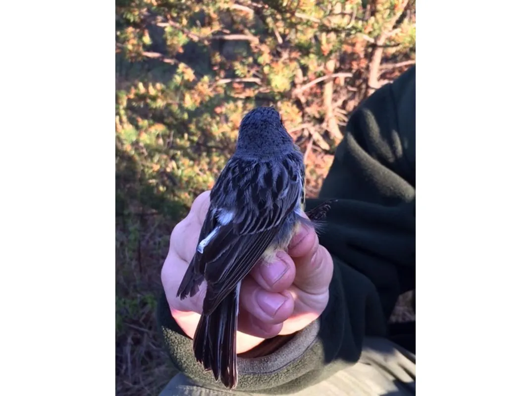
In 2014, Cooper and his team attached 60 geolocators, each weighing .5 grams, to male warblers at least two years old that they captured at breeding sites throughout Michigan’s Lower Peninsula. A year later, they returned to the same sites and recaptured nearly half of the same birds, retrieving 27 of the geolocators, now loaded with data.
“We were very happy with that,” Cooper says. “That’s a high rate for a geolocator study. It’s not uncommon to only get a third back, or less. But Kirtlands’ breeding range is limited, and we can look for them effectively. They’re site faithful, and they’re really easy to catch.” Scientists will set up a mist net near a known nesting site, then play the song of a male warbler. “Birds are in the net often before the first song is over. These guys are really aggressive.”
The data confirmed some of what researchers already believed, particularly that the vast majority of the birds winter in the central Bahamas. The biggest surprise, Cooper says, is that one bird spent the whole winter in Cuba.
“That finding is important because it gives us some hope for the future in terms of wintering grounds” if the Bahamas become untenable due to sea level rise or drought conditions killing off the birds’ winter food supply, he says. “This species could possibly evolve a new wintering location relatively rapidly as long as that baseline variation is there in the first place, and now we have evidence that it is.”
Using prevailing winds and weather patterns in spring and fall to follow what’s called a “loop route,” the birds averaged 1,700 miles in just 16 days. Another critical new piece of information was locating the stopover areas where they rested and refueled during migration. On the southbound flight, most birds stopped in southern Ontario or the upper mid-Atlantic states for their first rest.
They also stopped along the coastline in North or South Carolina to fuel up before making the jump across the open ocean to the Bahamas. For the return trip on a more westerly route, the birds crossed the Gulf Stream from the Bahamas and stopped along the Florida coast to recuperate. Further along, they stopped in southeastern Georgia, northern Florida, or southwestern South Carolina before making the jump over the Appalachians.
“Stopover has been a pretty big unknown for this species, but it’s potentially very important,” Cooper says. Conservation managers will have a better sense now of where the birds need habitat with sufficient shelter and food to rest and recover. Citizen scientists and birders can target these areas to help identify and monitor the birds as they travel. In April, Cooper and Marra will team up with the Cornell Lab of Ornithology to organize a “Kirtland’s Warbler Migration Blitz” specific to the Kirtland’s warbler as they return from their winter sojourn, and birders can focus on these stopover areas to try to identify the birds as they pass through.
Knowing stopover locations and travel routes will help Cooper and other scientists with the next innovative step in better understanding these birds, using a collaborative tracking system called Motus (Latin for movement) operated by Bird Studies Canada. On Cat Island in the Bahamas, Cooper and his team in March will be fitting 100 Kirtland’s with digitally encoded radio transmitters, a.k.a., nano-tags, enabling scientists to track the birds as they move past strategically located receivers.
“As the songbirds migrate, they pass through a gate of automated telemetry towers already up in Florida,” he says. “They will be auto-detected and the data saved and downloaded.” More towers are already up along the north shore of Lake Erie in Ontario and will be going up as well in the Michigan breeding grounds.
Marra says the integration of smaller technologies with citizen science programs applied to study these birds helps researchers get ever closer to the goal of understanding how they survive over the course of a full year.
“If we can track them throughout the year, we can ask much more sophisticated questions about their fundamental biology. Things that happen to individuals throughout the year drive their biology,” he says. “For example, climate change studies have been geared mostly toward the breeding period, but that’s only three months of the year. These birds are exposed to sea-level rise, changing weather patterns, the entire year, and we have to protect these populations throughout the year.”
/https://tf-cmsv2-smithsonianmag-media.s3.amazonaws.com/accounts/headshot/WendyClarke1.JPG)
/https://tf-cmsv2-smithsonianmag-media.s3.amazonaws.com/accounts/headshot/WendyClarke1.JPG)