A Breathtaking New Bridge
The construction of the bridge that bypasses the Hoover Dam was an Erector Set dream come true for this photographer
/https://tf-cmsv2-smithsonianmag-media.s3.amazonaws.com/filer/Hoover-Dam-bridge-awaiting-decking-631.jpg)
Jamey Stillings has been a professional photographer since 1983. His work has taken him across the country and to Nicaragua, India and the South Pacific island nation of Vanuatu. In March of 2009, he was between assignments when he decided to take what he calls a "photo road trip" from his home in Santa Fe to the Mojave Desert to scout some solar-power plants there.
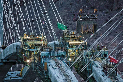
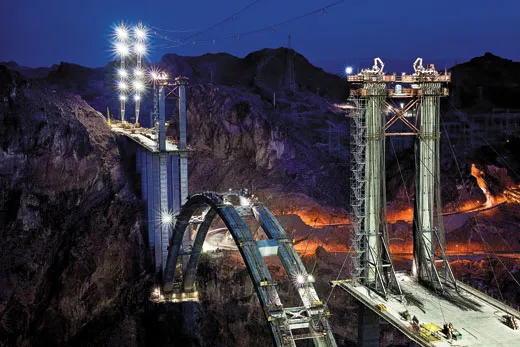
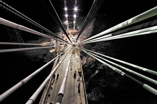
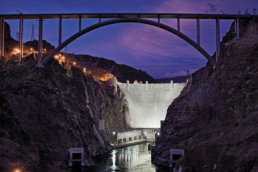
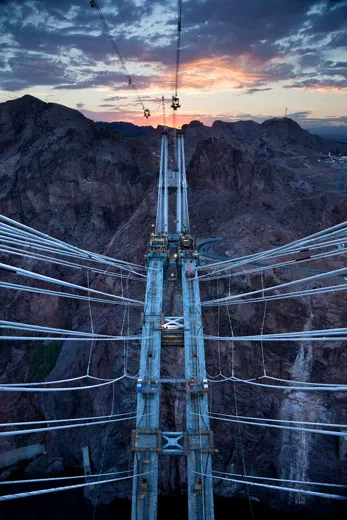
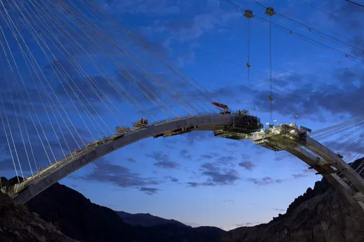
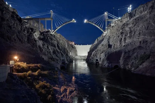
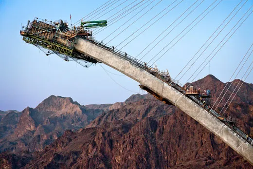
He didn't make it to the power plants that day. A sight at the Hoover Dam intervened: two legs of an incomplete arch had been anchored into opposite sides of a canyon about a quarter-mile south of the dam; they were held up by steel cables stretched over towering concrete pillars. Clearly, an epic bridge was underway. "I looked at the bridge and said, "Holy Toledo," recalls Stillings. "It played on all the Erector Set fantasies you could imagine. I've had a long-standing interest in the man-altered landscape, in places where man and nature intersect, and this was that on steroids."
It was sunset—the construction lights were coming on. "I just thought, wow, how about spending a day here?" he says. One day turned into more than 30 visits over the next year and a half as the bridge—centerpiece of the Hoover Dam bypass that opened this past October—took shape. Half a dozen times, he chartered a helicopter on his own dime.
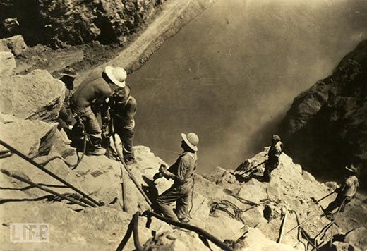
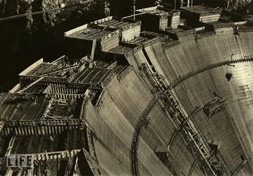
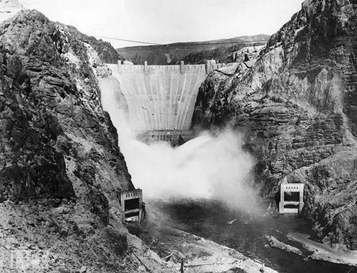
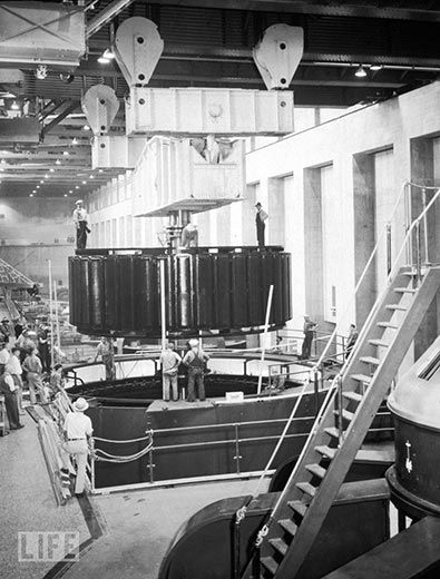
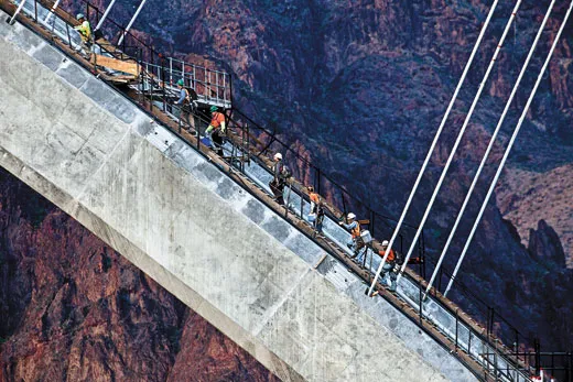
The dam, dedicated 75 years ago, remains one of the engineering wonders of the world: a concrete wall more than 1,200 feet long and 700 feet high that corked the Colorado River, created the startling blue vastness of Lake Mead and still provides water and electricity to three states. But the bridge is a worthy complement: it carries a four-lane highway almost 900 feet above the river, and it rests on the longest concrete arch in the United States, 1,060 feet. It was built to circumvent the dam-crossing stretch of U.S. Route 93, which was a narrow, tortuous and accident-prone kink in the designated NAFTA highway corridor between Mexico and Canada. Tourists can still drive across the dam, but others will be routed over what has been named the Mike O'Callaghan-Pat Tillman Memorial Bridge, commemorating, respectively, a popular 1970s Nevada governor and the former Arizona Cardinals football player killed by friendly fire in Afghanistan in 2004 while serving in the U.S. Army.
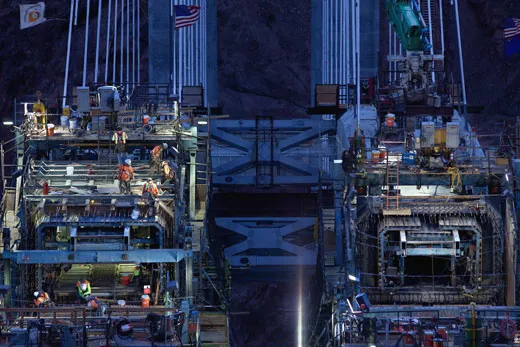
Stillings says he'd like his photographs of the bridge to commemorate the talent and labor of those who built it. But he acknowledges, too, a lingering sadness now that the project is finished. "The evolution of something is more interesting than its completion," he says. "We don't yet understand everything about what it's going to become."
Jamey Stillings is a photographer based in Santa Fe. T.A. Frail is a senior editor at Smithsonian.
Planning Your Next Trip?
Explore great travel deals
Smithsonian magazine participates in affiliate link advertising programs. If you purchase an item through these links, we receive a commission.
/https://tf-cmsv2-smithsonianmag-media.s3.amazonaws.com/accounts/headshot/tom-frail-head-shot.jpeg)
/https://tf-cmsv2-smithsonianmag-media.s3.amazonaws.com/accounts/headshot/tom-frail-head-shot.jpeg)