Before Going to the Moon, Apollo 11 Astronauts Trained at These Five Sites
From Arizona to Hawaii, these landscapes—similar in ways to the surface of the moon—were critical training grounds for the crew
/https://tf-cmsv2-smithsonianmag-media.s3.amazonaws.com/filer/90/91/9091b989-5301-4813-bc59-3e46c8648b80/neil_armstrong_and_buzz_aldrin_sierra_blanca.jpg)
Before Neil Armstrong could take his “small step for a man” on July 20, 1969, he and the rest of the Apollo 11 crew underwent a rigorous regimen of training to prepare for their mission to the moon. While much of their instruction took place inside the classroom and at testing facilities, NASA also charged the astronauts with tasks like collecting geological specimens and entering and exiting the lunar module to help build muscle memory to replicate these activities on the moon. To make their training as realistic as possible, the crew trained at sites right here on Earth that looked eerily similar to the topography of the moon.
“[NASA] was looking for places that would roughly approximate the geological features of the moon,” says Stephen Garber, a policy analyst in the NASA History Program Office, “but since we hadn’t been there before, it was something of a guessing game.”
During their training, astronauts Neil Armstrong, Buzz Aldrin and Michael Collins underwent frequent field trips both nationally and internationally, although the bulk of their fieldwork was based in the American Southwest at locations in Arizona, Texas and Nevada.
“The reason they trained at so many sites was to get an appreciation for the different aspects of various geological features [they would come in contact with during their mission]” Garber says. “They also had a combination of classroom training and field training, although the field training was really emphasized a fair amount because [NASA] wanted to ingrain the procedures in the astronauts’ muscle memory, so they wouldn’t have to spend a lot of time worrying about how to take a sample or how to take a photo. Scientists back on Earth could analyze the samples and photos later on; the astronauts had enough to do and the point was to get them home safely.”
Using their hands and small shovels, the astronauts repeatedly practiced collecting and analyzing rock and soil samples at different sites so that the process would become ingrained in them once they arrived on the moon. Other equally important simulations they conducted involved selecting site locations, digging trenches and collecting samples at different levels, driving core tubes into the soil for sample collection, describing geological characteristics both verbally and in written format, documenting sites using photography, and adequately labeling the samples they collected.
Seeing the benefits of training at lunar analogues, which are defined as areas on Earth that are used to simulate the topography and geology of the moon, NASA made analog missions a common training tool for astronauts preparing for future space travel, including for subsequent Apollo missions.
Now, with the 50th anniversary of Apollo 11 quickly approaching, these training sites serve as a physical reminder of one of humankind’s greatest accomplishments. Here are five locations in the United States that you can visit:
Cinder Lake Crater Field, Arizona
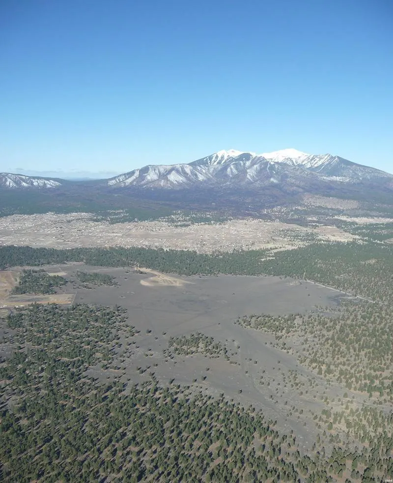
Between July and October of 1967, NASA was on a mission to turn a 500-foot-by-500-foot site just outside of Flagstaff, Arizona, into a mirror image of a portion of the moon’s surface. Armed with tons of TNT and ammonium nitrate, NASA worked with the U.S. Geological Survey (USGS) to blast craters into this swath of land chosen for its many layers of volcanic cinders, which approximated the look and feel of the moon’s surface. Workers used satellite imagery as their guide to duplicate the topography on a 1:1 scale. Over the course of the next 120 days, workers created 47 craters with diameters measuring between 5 feet and 43 feet, approximating Mare Tranquillitatis (Sea of Tranquility), Apollo 11’s planned lunar landing site.
During their field training, the crew visited this manmade crater field inside the lunar module and were tested on their ability to name their location by only looking out of the LM’s windows at the topography around them and pinpointing it on satellite images. Over the years, NASA and the USGS would create additional crater fields to train astronauts for future Apollo missions. Although the craters aren’t as pronounced as they were 50 years ago due to weathering and human use (they're particularly popular with off-roaders and ATVs), they’re still visible and accessible to the public.
Grand Canyon, Arizona
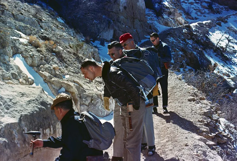
While all three Apollo astronauts were well versed in operating the Command Module Columbia, the spacecraft that would rocket them into space, and the LM that would shuttle them safely to the moon, they needed to brush up on their geology skills. Since one of the main focuses of their mission was to collect lunar samples, the crew worked closely with geologists here on Earth on how to gather and study rock samples. One place in particular where they did field training was in the Grand Canyon. For two days in early March 1964, the crew learned basic geological principles such as how to identify and collect various types of rocks. The group hiked the South Kaibab Trail to the bottom of the canyon and then had to identify their location using topographic maps and satellite images, before ascending on the Bright Angel Trail the following day. Both trails remain popular day hikes and give visitors the chance to trace the astronauts’ footsteps.
Astronauts in training noted that their time spent in the Grand Canyon were some of the most beneficial in their training as a whole, with one unnamed astronaut saying to the geologists that, "we've listened to you for two weeks [in a classroom setting] and not understood. And one field trip has shown us the importance and the reasons for all of the discussion."
Sierra Blanca, Texas
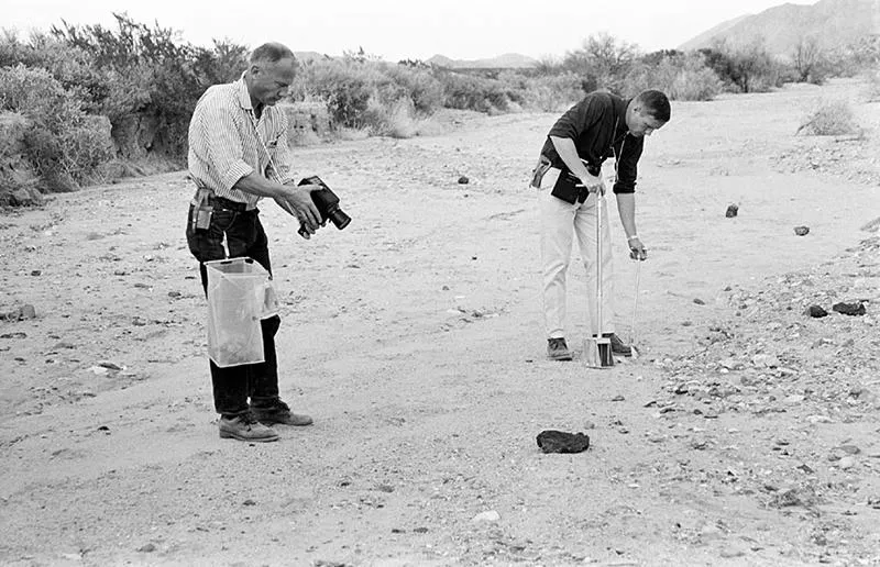
Located about 90 miles southeast of El Paso, Sierra Blanca, near the Quitman Mountains, is peppered with volcanic rocks, making it a good location for Apollo 11 mission training. On February 24, 1969, Armstrong and Aldrin, the two astronauts assigned with completing the moonwalk, joined a team of geologists in an exercise that tasked them with properly identifying and describing rock samples using tape recorders and VOX microphones and capturing their work on camera, actions they would have to replicate on the moon. Although the exercise may sound straightforward, the astronauts had to accurately identify a multitude of samples from various sites in the area and correctly name each one. While visually many of the rocks appeared similar, upon cracking them open they were different, adding a layer of difficulty to the task.
Nevada National Security Site, Nevada
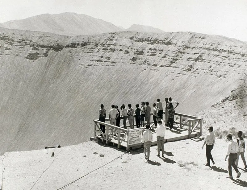
Of all the test sites that the astronauts visited, in recordings from their mission to the moon, the crew cited the Nevada National Security Site (also known as the Nevada Test Site) as the most beneficial to their training. In fact, the site located just east of Death Valley National Park would become a recurring spot for future Apollo astronauts to train, as it was considered by geologists to be “an ideal training site.”
During a three-day field trip in February 1965, the Apollo 11 crew carried out numerous geological and geophysical studies at Sedan and Schooner craters and Buckboard Mesa, fine-tuning their ability to collect samples. They also explored ancient volcanic formations that closely resembled the surface of the moon, including the Timber Mountain caldera. Today, the NNSS offers monthly tours of the area (unfortunately, access to the caldera is restricted), and reservations are required.
Various Locations, Hawaii
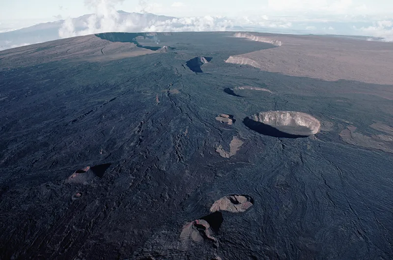
While most of the astronauts’ fieldwork was done at sites over the course of a day or two, the Apollo 11 crew spent an extensive amount of time in January 1965 training on the ground in Hawaii thanks to its abundance of volcanoes. It was during these excursions both on foot and via airplane that the astronauts got a chance to study the different physical aspects of volcanoes, including gas and lava vents, lava lakes, pit craters and more. During the final days of their stay, they hiked to the top of the 13,677-foot Mauna Loa, known as the world’s largest volcano, to observe its summit crater. Four years later they would revisit Hawaii again upon completion of their lunar mission, splashing down in the Pacific Ocean via the Command Module Columbia. To trace their footsteps, there are two ways to ascend to the top of Mauna Loa. One involves obtaining a permit, but the other is a more gradual roundtrip hike of 13 miles.
Planning Your Next Trip?
Explore great travel deals
Smithsonian magazine participates in affiliate link advertising programs. If you purchase an item through these links, we receive a commission.